File:LondonBoroughBexleyPlaceNameMap.png
Size of this preview: 500 × 599 pixels. Other resolutions: 200 × 240 pixels | 400 × 480 pixels | 501 × 600 pixels | 641 × 768 pixels | 1,200 × 1,438 pixels.
Original file (1,200 × 1,438 pixels, file size: 1.43 MB, MIME type: image/png)
| This is a file from the Wikimedia Commons. The description on its description page there is shown below.
|
Summary
| Description |
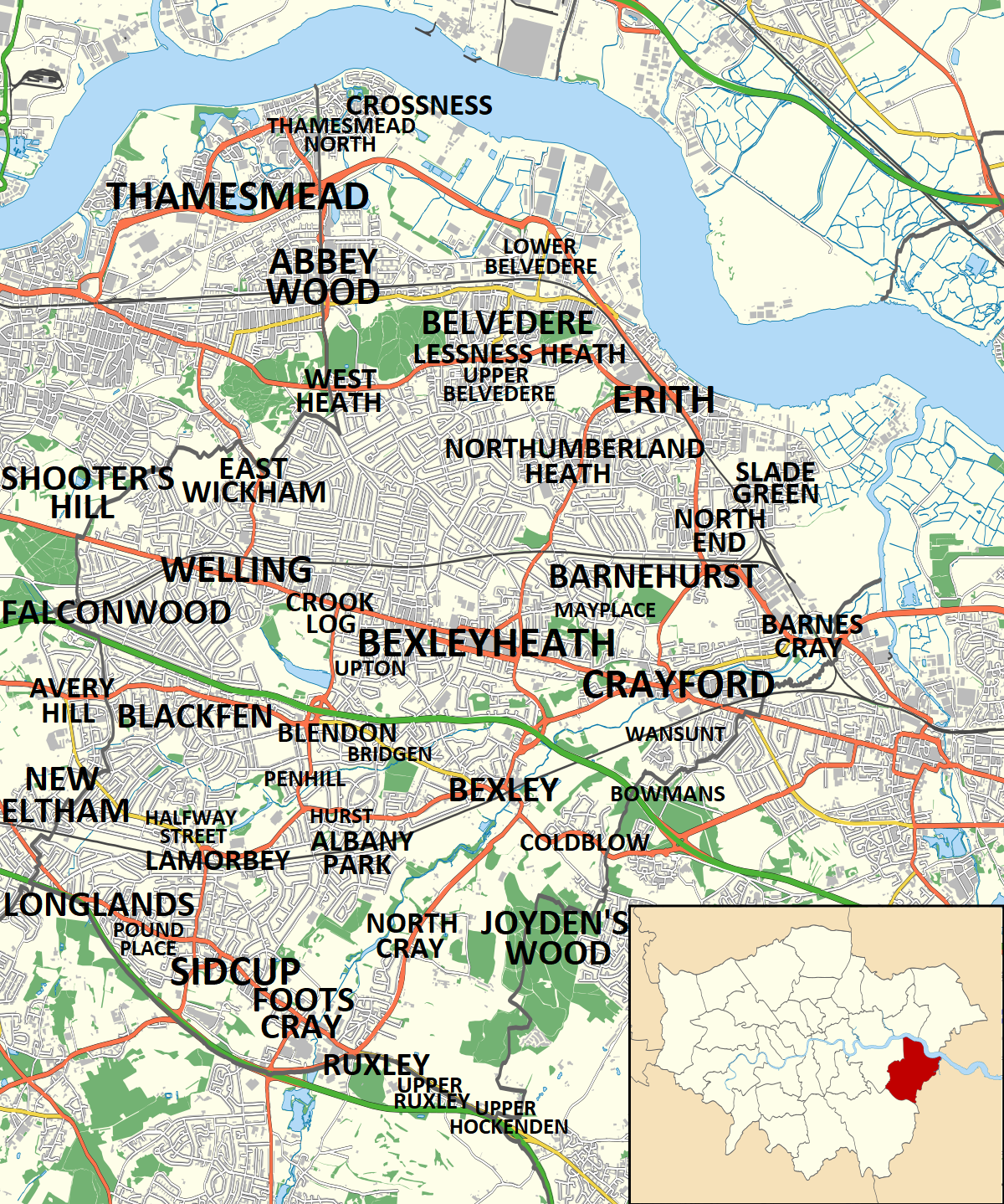
English: Map of the London Borough of Bexley with place names |
| Date | |
| Source | Own work OS map data |
| Author | created byUser:Nilfanion, altered by Carlwev |
Licensing
I, the copyright holder of this work, hereby publish it under the following license:
This file is licensed under the Creative Commons Attribution-Share Alike 4.0 International license.
- You are free:
- to share – to copy, distribute and transmit the work
- to remix – to adapt the work
- Under the following conditions:
- attribution – You must give appropriate credit, provide a link to the license, and indicate if changes were made. You may do so in any reasonable manner, but not in any way that suggests the licensor endorses you or your use.
- share alike – If you remix, transform, or build upon the material, you must distribute your contributions under the same or compatible license as the original.
| Description |
Location map of the London Borough of Bexley with the following information shown:
Equirectangular map projection on WGS 84 datum, with N/S stretched 160% Geographic limits:
|
| Date | |
| Source |
|
| Author | Nilfanion |
| Permission (Reusing this file) |
This file is licensed under the Creative Commons Attribution-Share Alike 3.0 Unported license. Attribution: Contains Ordnance Survey data © Crown copyright and database right
|
File history
Click on a date/time to view the file as it appeared at that time.
| Date/Time | Dimensions | User | Comment | |
|---|---|---|---|---|
| current | 14:52, 30 March 2022 | 1,200 × 1,438 (1.43 MB) | Carlwev | Uploaded own work with UploadWizard |
File usage
The following page uses this file: