File:Lower Mills MA.jpg

Size of this preview: 800 × 535 pixels. Other resolutions: 320 × 214 pixels | 640 × 428 pixels | 1,024 × 685 pixels | 1,200 × 803 pixels.
Original file (1,200 × 803 pixels, file size: 381 KB, MIME type: image/jpeg)
| This is a file from the Wikimedia Commons. The description on its description page there is shown below.
|
|
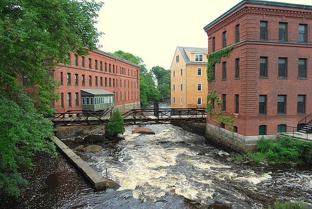
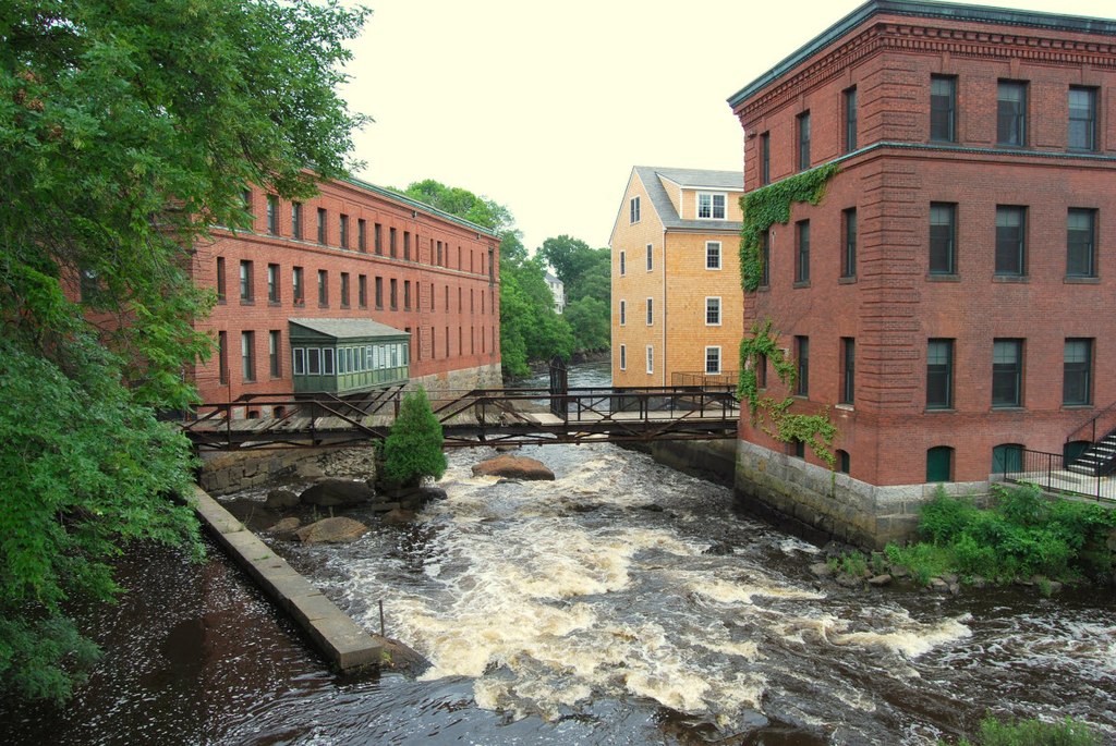
This is an image of a place or building that is listed on the National Register of Historic Places in the United States of America. Its reference number is 80000675. |
Summary
| Description |
English: Lower Mills Village, Massachusetts, spanning both sides of the Neponset River between Milton (on the right) and City of Boston (Dorchester) (on the left). These buildings were once part of the Walter Baker Chocolate Factory. |
| Date | |
| Source | Own work |
| Author | Marcbela (Marc N. Belanger) |
| Object location | | View this and other nearby images on: OpenStreetMap |
|---|
Licensing
| I, the copyright holder of this work, release this work into the public domain. This applies worldwide. In some countries this may not be legally possible; if so: I grant anyone the right to use this work for any purpose, without any conditions, unless such conditions are required by law. |
File history
Click on a date/time to view the file as it appeared at that time.
| Date/Time | Dimensions | User | Comment | |
|---|---|---|---|---|
| current | 06:42, 4 July 2009 | 1,200 × 803 (381 KB) | Marcbela | {{Information |Description={{en|1=Lower Mills Village, Massachusetts, spanning both sides of the Neponset River between the Town of Milton (on the right) and City of Boston (Dorchester) (on the left). These buildings were once part of the Walter Baker Cho |
File usage
The following page uses this file: