File:MSH80 mailboxes along cowlitz river 1980.jpg
Original file(2,919 × 1,905 pixels, file size: 1.78 MB, MIME type: image/jpeg)

Commons-logo.svg This is a file from the Wikimedia Commons. The description on its description page there is shown below.
Commons is a freely licensed media file repository. You can help.

Summary

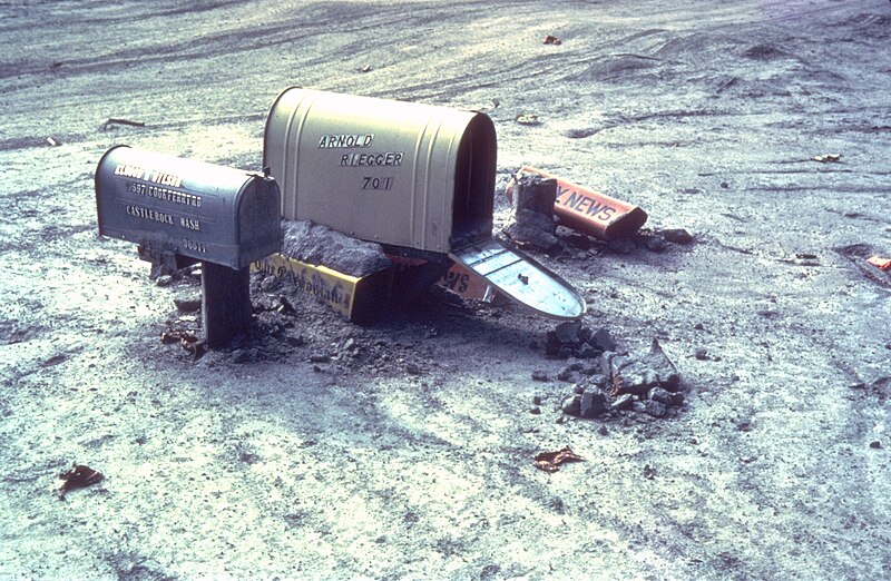
Description Mailboxes sticking out of a mudflow along the Cowlitz River in Castle Rock, Washington after the May 18, 1980 explosion of Mount St. Helens
Date Summer 1980
date QS:P,+1980-00-00T00:00:00Z/9,P4241,Q40720564
Source Archived source link
Author Lyn Topinka, USGS
Camera location46° 15′ 18.72″ N, 122° 53′ 52.08″ W Kartographer map based on OpenStreetMap.View this and other nearby images on: OpenStreetMapinfo

Licensing

Public domain
This image is in the public domain in the United States because it only contains materials that originally came from the United States Geological Survey, an agency of the United States Department of the Interior. For more information, see the official USGS copyright policy.

Bahasa Indonesia  català  čeština  Deutsch  eesti  English  español  français  galego  italiano  Nederlands  português  polski  sicilianu  suomi  Tiếng Việt  Türkçe  български  македонски  русский  മലയാളം  한국어  日本語  中文  中文(简体)  中文(繁體)  العربية  فارسی  +/−

Captions

mailboxes sticking out of a mudflow along the Cowlitz River in Castle Rock, Washington after the May 18, 1980 explosion of Mount St. Helens

Items portrayed in this file

depicts

46°15'18.7"N, 122°53'52.1"W

File history

Click on a date/time to view the file as it appeared at that time.

Date/TimeDimensionsUserComment
current10:28, 31 March 20062,919 × 1,905 (1.78 MB)Mnh==English== {{Information| |Description=Mailboxes in the mudflow along the Cowlitz River created by the May 18th, 1980 eruption of the Mount St. Helens. |Source=[http://vulcan.wr.usgs.gov/Volcanoes/MSH/Images/mudflow_images.html USGS Cascades Volcano Obse

The following page uses this file: