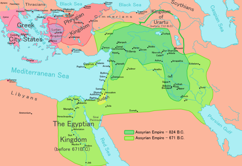
File:Map of Assyria.png
Original file(1,983 × 1,363 pixels, file size: 160 KB, MIME type: image/png)

Commons-logo.svg This is a file from the Wikimedia Commons. The description on its description page there is shown below.
Commons is a freely licensed media file repository. You can help.
Description

[edit]

English: Map of the Assyrian Empire
Español: Extensión del Imperio Asirio
Polski: Mapa Asyrii w 824 i 671 r. p.n.e.
Português: Extensão do Império Assírio
العربية : خارطة الإمبراطوريَّة الآشوريَّة.
فارسی : نقشه امپراتوری آشور
Date
Source

Own work data from

  • Based on a map in 'Atlas of the Bible Lands', C S Hammond & Co (1959), ISBN 9780843709414.
Author Ningyou
Permission
(Reusing this file)
Public domain I, the copyright holder of this work, release this work into the public domain. This applies worldwide.
In some countries this may not be legally possible; if so:
I grant anyone the right to use this work for any purpose, without any conditions, unless such conditions are required by law.
Other versions

[edit]

Captions

Map of the Assyrian Empire 824 BCE to 671 BCE

Items portrayed in this file

depicts

26 February 2006

image/png

File history

Click on a date/time to view the file as it appeared at that time.

Date/TimeDimensionsUserComment
current05:32, 24 May 20181,983 × 1,363 (160 KB)Capmocorrected typos in Trapezus and Hamath

The following 3 pages use this file:

Metadata