File:Map of Atlantic off-season storms.png

Size of this preview: 800 × 578 pixels. Other resolutions: 320 × 231 pixels | 640 × 463 pixels | 1,024 × 740 pixels | 1,280 × 926 pixels | 1,809 × 1,308 pixels.
Original file (1,809 × 1,308 pixels, file size: 1.38 MB, MIME type: image/png)
| This is a file from the Wikimedia Commons. The description on its description page there is shown below.
|
Summary
| Description |
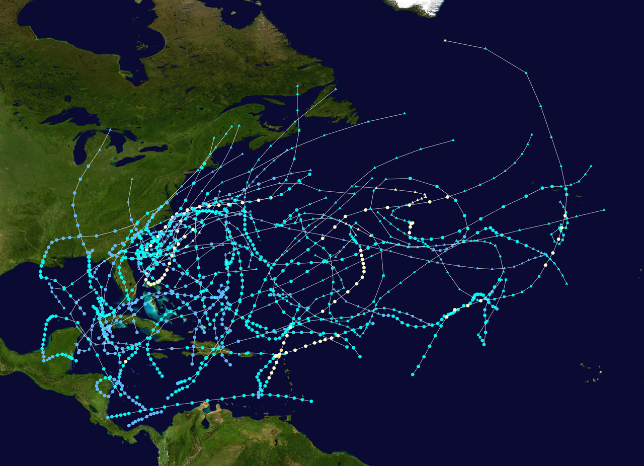
English: Track map of all off-season storms in the North Atlantic Basin. The points show the location of the storm at 6-hour intervals. The colour represents the storm's maximum sustained wind speeds as classified in the Saffir-Simpson Hurricane Scale (see below), and the shape of the data points represent the nature of the storm, according to the legend below.
Tropical depression (≤38 mph, ≤62 km/h)
Tropical storm (39–73 mph, 63–118 km/h)
Category 1 (74–95 mph, 119–153 km/h)
Category 2 (96–110 mph, 154–177 km/h)
Category 3 (111–129 mph, 178–208 km/h)
Category 4 (130–156 mph, 209–251 km/h)
Category 5 (≥157 mph, ≥252 km/h)
Unknown
Storm type |
| Date | |
| Source | Created by Sria-72 using Wikipedia:WikiProject Tropical cyclones/Tracks. The background image is from NASA. Tracking data is from the National Hurricane Center.[1]. |
| Author | Original work of Sria-72, requested to upload by Sandy14156 |
Licensing
| This work has been released into the public domain by its author, Sria-72. This applies worldwide. In some countries this may not be legally possible; if so: |
File history
Click on a date/time to view the file as it appeared at that time.
| Date/Time | Dimensions | User | Comment | |
|---|---|---|---|---|
| current | 18:20, 5 September 2023 | 1,809 × 1,308 (1.38 MB) | Sandy14156 | Uploaded a work by Original work of Sria-72, requested to upload by Sandy14156 from Created by Sria-72 using Wikipedia:WikiProject Tropical cyclones/Tracks. The background image is from NASA. Tracking data is from the {{w|National Hurricane Center}}.<sup>[http://www.nhc.noaa.gov/pastall.shtml]</sup>. with UploadWizard |
File usage
The following page uses this file: