File:Map of Burksville and Jennings Ordinary Area of Nottoway County, Virginia, from 1864.jpg

Size of this preview: 800 × 461 pixels. Other resolutions: 320 × 184 pixels | 640 × 369 pixels | 1,024 × 590 pixels | 1,280 × 738 pixels | 2,781 × 1,603 pixels.
Original file (2,781 × 1,603 pixels, file size: 868 KB, MIME type: image/jpeg)
| This is a file from the Wikimedia Commons. The description on its description page there is shown below.
|
Summary
| Description |
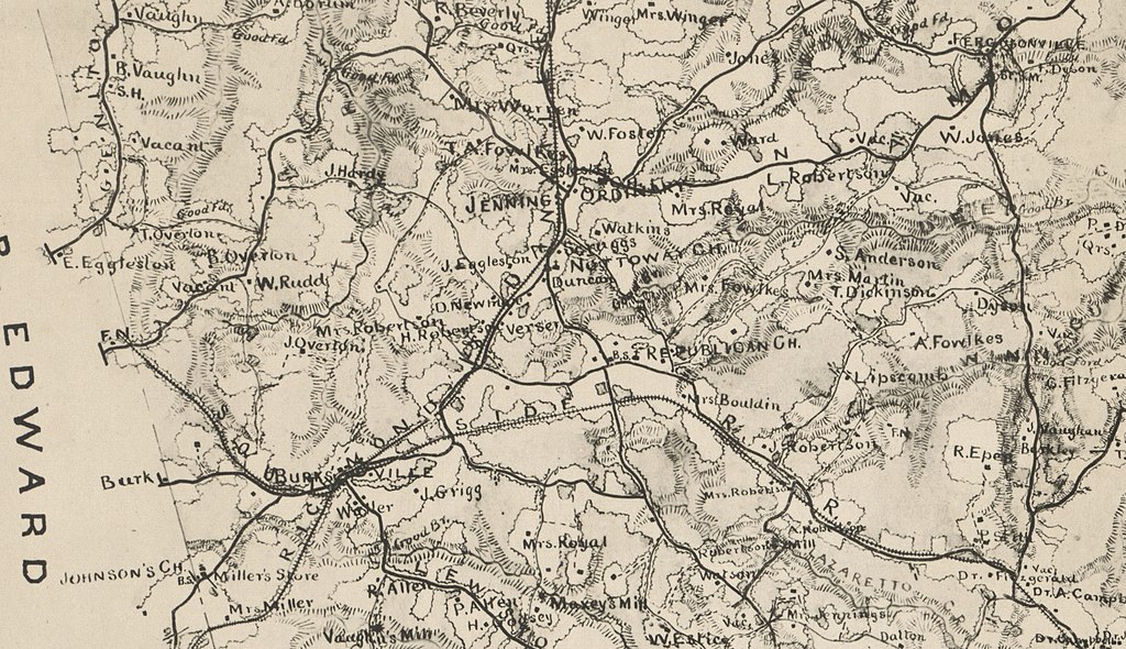
English: Close up of Burksville and Jennings Ordinary Area of Nottoway County, Virginia, taken from 1864 Map of Nottoway County available at the Library of Congress website |
| Date | |
| Source | https://www.loc.gov/resource/g3883n.la001314/ |
| Author | Albert Henry Campbell (1826-1899) |
| Camera location | | View this and other nearby images on: OpenStreetMap |
|---|
Licensing
|
This work is in the public domain in its country of origin and other countries and areas where the copyright term is the author's life plus 70 years or fewer. This work is in the public domain in the United States because it was published (or registered with the U.S. Copyright Office) before January 1, 1929. | |
| This file has been identified as being free of known restrictions under copyright law, including all related and neighboring rights. | |
File history
Click on a date/time to view the file as it appeared at that time.
| Date/Time | Dimensions | User | Comment | |
|---|---|---|---|---|
| current | 14:01, 18 May 2020 | 2,781 × 1,603 (868 KB) | Michael Sechler | Uploaded a work by Albert Henry Campbell (1826-1899) from https://www.loc.gov/resource/g3883n.la001314/ with UploadWizard |
File usage
The following page uses this file: