File:Map of Cambrai 1710.jpg
Size of this preview: 800 × 573 pixels. Other resolutions: 320 × 229 pixels | 640 × 459 pixels | 1,024 × 734 pixels | 1,280 × 917 pixels | 1,884 × 1,350 pixels.
Original file (1,884 × 1,350 pixels, file size: 841 KB, MIME type: image/jpeg)
| This is a file from the Wikimedia Commons. The description on its description page there is shown below.
|
Summary
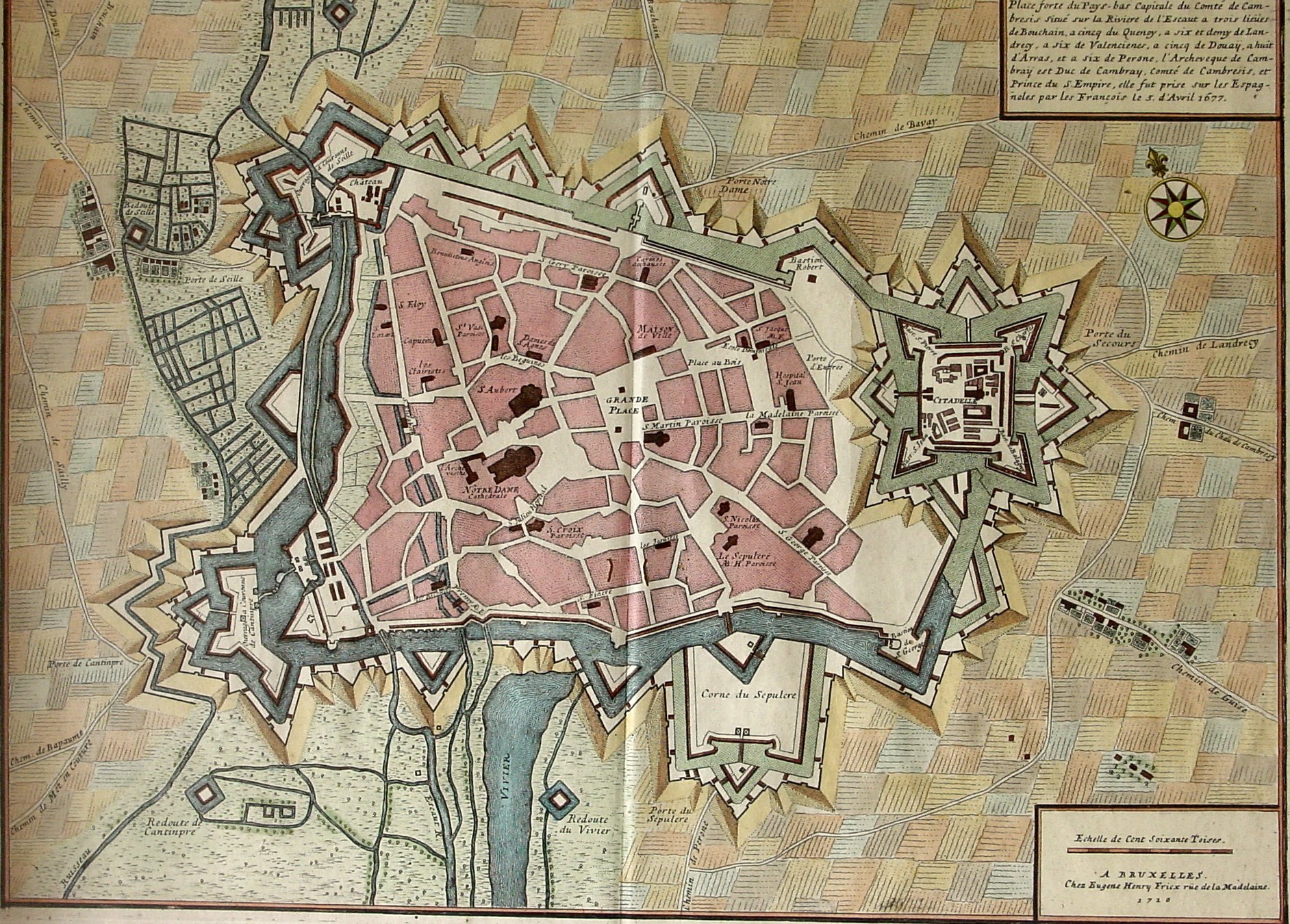
| Description | Plan de Cambrai fait en 1710 chez Eugène Henry Friex rue de la Madelaine à Bruxelles |
| Date | (image cropped 14 oct 2007) |
| Source | Own work |
| Author | Camster2 |
Licensing
I, the copyright holder of this work, hereby publish it under the following licenses:

|
Permission is granted to copy, distribute and/or modify this document under the terms of the GNU Free Documentation License, Version 1.2 or any later version published by the Free Software Foundation; with no Invariant Sections, no Front-Cover Texts, and no Back-Cover Texts. A copy of the license is included in the section entitled GNU Free Documentation License. |
This file is licensed under the Creative Commons Attribution-Share Alike 3.0 Unported, 2.5 Generic, 2.0 Generic and 1.0 Generic license.
- You are free:
- to share – to copy, distribute and transmit the work
- to remix – to adapt the work
- Under the following conditions:
- attribution – You must give appropriate credit, provide a link to the license, and indicate if changes were made. You may do so in any reasonable manner, but not in any way that suggests the licensor endorses you or your use.
- share alike – If you remix, transform, or build upon the material, you must distribute your contributions under the same or compatible license as the original.
You may select the license of your choice.
File history
Click on a date/time to view the file as it appeared at that time.
| Date/Time | Dimensions | User | Comment | |
|---|---|---|---|---|
| current | 08:23, 14 October 2007 | 1,884 × 1,350 (841 KB) | Camster | {{Information |Description=Plan de Cambrai fait en 1710 chez Eugène Henry Friex rue de la Madelaine à Bruxelles |Source=travail personnel |Date=10 avril 2007 (image cropped 14 oct 2007) |Author= Camster2 }} Category:Cambrai [[Cate |
File usage
The following page uses this file: