File:Map of Eyre Peninsula, South Australia, showing places with a population of more than 500.jpg
Size of this preview: 621 × 599 pixels. Other resolutions: 249 × 240 pixels | 497 × 480 pixels | 622 × 600 pixels | 796 × 768 pixels | 1,061 × 1,024 pixels | 4,317 × 4,166 pixels.
Original file (4,317 × 4,166 pixels, file size: 11 MB, MIME type: image/jpeg)
| This is a file from the Wikimedia Commons. The description on its description page there is shown below.
|
Summary
| Description |
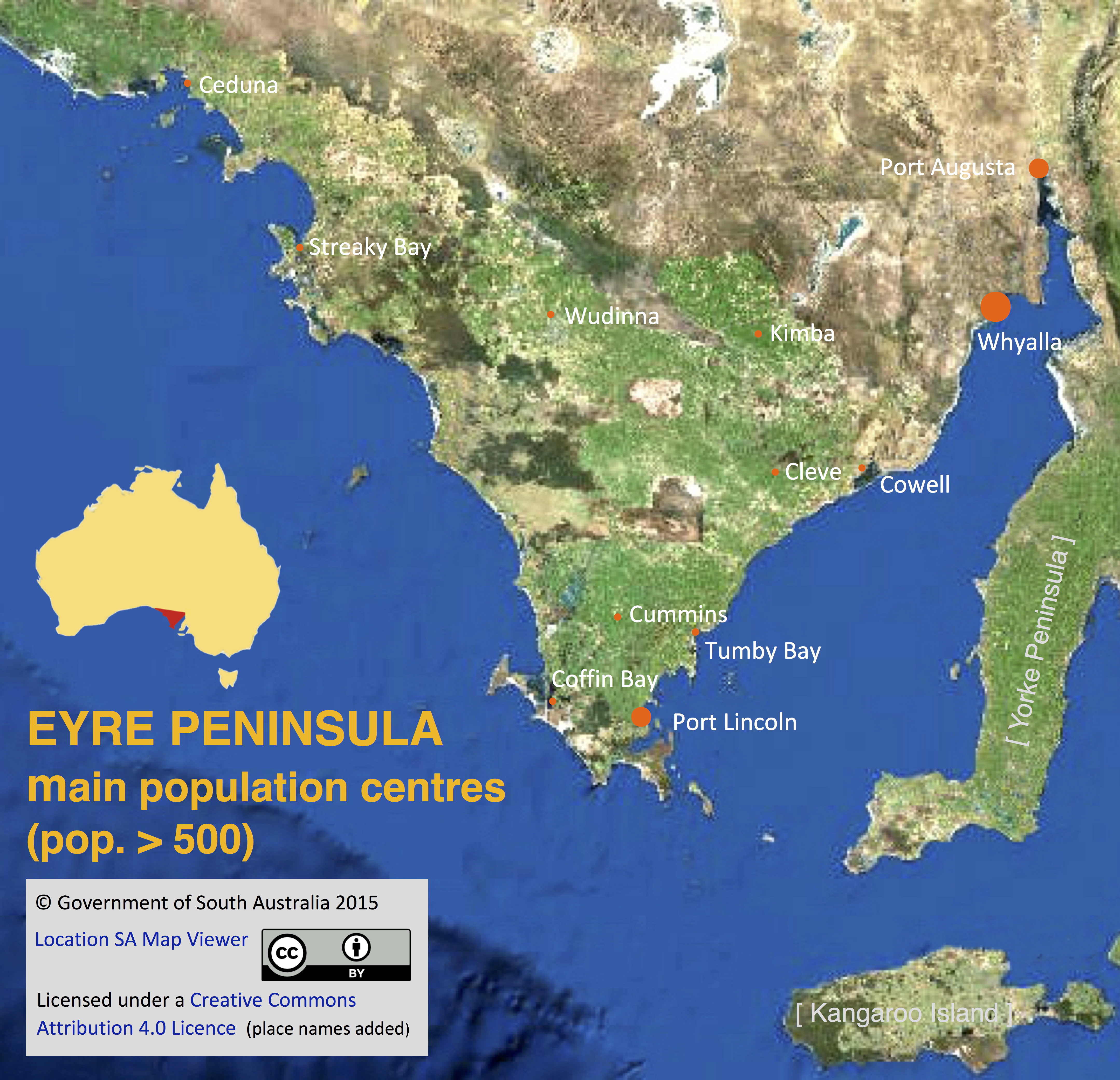
English: A satellite image of Eyre Peninsula, South Australia, imposed with names and locations of towns and cities with a population of more than 500 as recorded in the 2011 Australian census. |
| Date | |
| Source | http://location.sa.gov.au/viewer/ |
| Author | Government of South Australia |
| Permission (Reusing this file) |
At the source page, the 'Help' menu pop-down includes the statement 'This Government of South Australia website is licensed under a Creative Commons Attribution 4.0 Licence. © Copyright 2015' |
- Other information
English: Names and locations of population centres have been added to the image by SCHolar44, as permitted by CC BY 4.0, together with copyright information.
Licensing
This file is licensed under the Creative Commons Attribution 4.0 International license.
- You are free:
- to share – to copy, distribute and transmit the work
- to remix – to adapt the work
- Under the following conditions:
- attribution – You must give appropriate credit, provide a link to the license, and indicate if changes were made. You may do so in any reasonable manner, but not in any way that suggests the licensor endorses you or your use.
File history
Click on a date/time to view the file as it appeared at that time.
| Date/Time | Dimensions | User | Comment | |
|---|---|---|---|---|
| current | 02:23, 6 September 2017 | 4,317 × 4,166 (11 MB) | SCHolar44 | {{subst:Upload marker added by en.wp UW}} {{Information |Description = {{en|A satellite image of Eyre Peninsula, South Australia, imposed with names and locations of towns and cities with a population of more than 500 as recorded in the 2011 Australian... |
File usage
The following page uses this file: