File:Map of Kentucky NA (cropped).png
Size of this preview: 800 × 564 pixels. Other resolutions: 320 × 226 pixels | 640 × 451 pixels | 1,024 × 722 pixels | 1,280 × 902 pixels | 1,562 × 1,101 pixels.
Original file (1,562 × 1,101 pixels, file size: 1.12 MB, MIME type: image/png)
| This is a file from the Wikimedia Commons. The description on its description page there is shown below.
|
Summary
| Description |
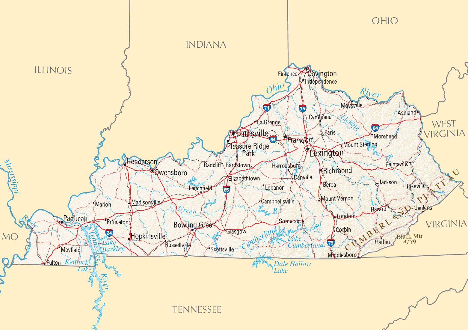
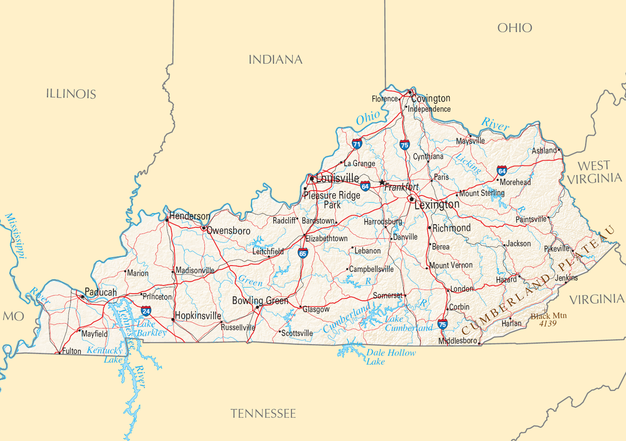
English: Reference Map of Kentucky. |
| Date | |
| Source | |
| Author | National Atlas of the United States |
| Permission (Reusing this file) |
Public domain |
| Other versions |

.png)
Licensing
This map was obtained from an edition of the National Atlas of the United States. Like almost all works of the U.S. federal government, works from the National Atlas are in the public domain in the United States.
Online access: NationalAtlas.gov | 1970 print edition: Library of Congress, Perry-Castañeda Library
|
File history
Click on a date/time to view the file as it appeared at that time.
| Date/Time | Dimensions | User | Comment | |
|---|---|---|---|---|
| current | 14:26, 29 August 2016 | 1,562 × 1,101 (1.12 MB) | GreenMeansGo | File:Map of Kentucky NA.png cropped 26 % horizontally and 33 % vertically using CropTool with precise mode. |
File usage
The following page uses this file:
.png)