File:Map of Spitalfields Area - 1787.jpg
No higher resolution available.
Map_of_Spitalfields_Area_-_1787.jpg (557 × 418 pixels, file size: 130 KB, MIME type: image/jpeg)
| This is a file from the Wikimedia Commons. The description on its description page there is shown below.
|
Summary
| Description |
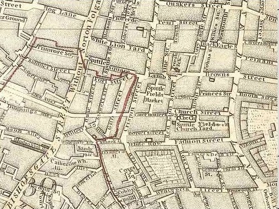
English: Map, publisher unknown, dated 1787, showing Spitalfields (Spittlefields) and its environs |
||||
| Date | |||||
| Source | http://gerald-massey.org.uk/bezer/b_autobiography.htm | ||||
| Author | Unknown author; map first published 1787 | ||||
| Permission (Reusing this file) |
|
||||
| Camera location | | View this and other nearby images on: OpenStreetMap |
|---|
File history
Click on a date/time to view the file as it appeared at that time.
| Date/Time | Dimensions | User | Comment | |
|---|---|---|---|---|
| current | 08:15, 18 August 2013 | 557 × 418 (130 KB) | Clavileno | User created page with UploadWizard |
File usage
The following page uses this file: