File:Map of electric street lighting in Tamworth NSW, 1888.jpg

Size of this preview: 800 × 580 pixels. Other resolutions: 320 × 232 pixels | 640 × 464 pixels | 1,024 × 743 pixels | 1,280 × 929 pixels | 3,090 × 2,242 pixels.
Original file (3,090 × 2,242 pixels, file size: 1.41 MB, MIME type: image/jpeg)
| This is a file from the Wikimedia Commons. The description on its description page there is shown below.
|
Summary
| Description |
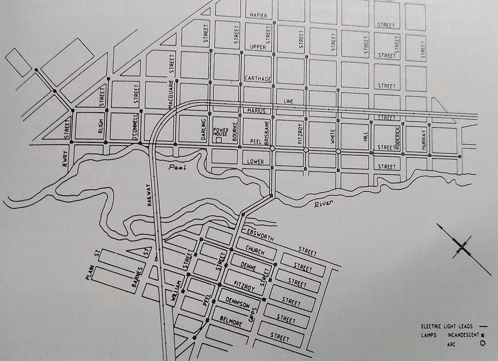
English: Map of Tamworth NSW showing the position along the network of city streets of the Electric Light Station leads, incandescent lamps and arc lamps for the first widespread and permanent city electric street lighting in the Southern Hemisphere. |
| Date | |
| Source | Proceedings of Institute of Engineers, London (1890) |
| Author | Unknown author |
| Camera location | | View this and other nearby images on: OpenStreetMap |
|---|
Licensing
|
This work is in the public domain in its country of origin and other countries and areas where the copyright term is the author's life plus 70 years or fewer. This work is in the public domain in the United States because it was published (or registered with the U.S. Copyright Office) before January 1, 1929. | |
| This file has been identified as being free of known restrictions under copyright law, including all related and neighboring rights. | |
File history
Click on a date/time to view the file as it appeared at that time.
| Date/Time | Dimensions | User | Comment | |
|---|---|---|---|---|
| current | 21:08, 8 November 2018 | 3,090 × 2,242 (1.41 MB) | RobotWrangler | User created page with UploadWizard |
File usage
The following page uses this file: