File:Mapa da densidade populacional do município de Braga.jpg
Size of this preview: 800 × 566 pixels. Other resolutions: 320 × 226 pixels | 640 × 453 pixels | 1,024 × 724 pixels | 1,280 × 905 pixels | 4,677 × 3,307 pixels.
Original file (4,677 × 3,307 pixels, file size: 1.39 MB, MIME type: image/jpeg)
| This is a file from the Wikimedia Commons. The description on its description page there is shown below.
|
Summary
| Description |
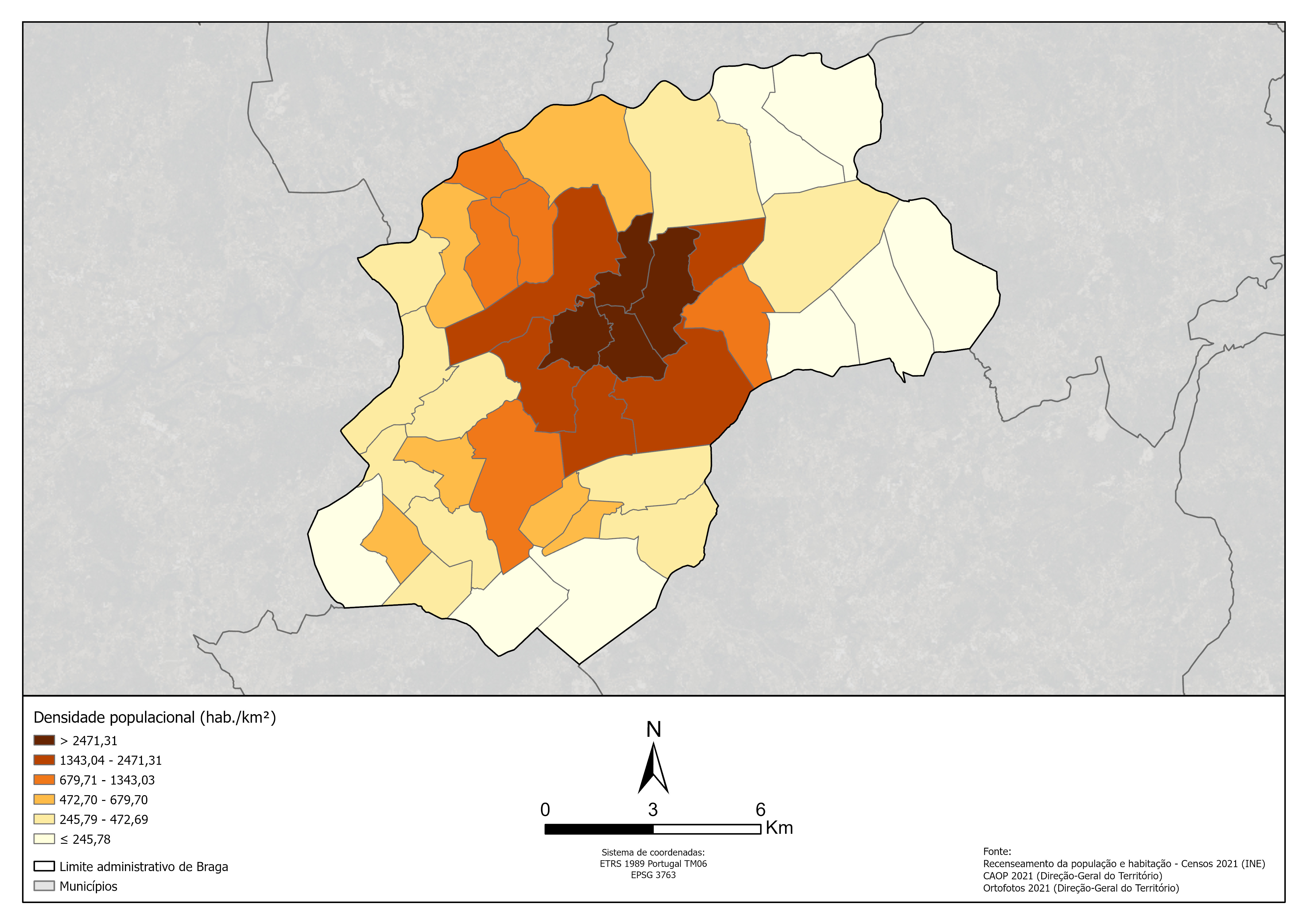
Português: A imagem representa a densidade populacional (número de habitantes das freguesias pela sua área em quilómetros quadrados) de Braga.
A densidade populacional foi dividida em 6 classes de quebras naturais para representar a diversidade do município sem que dificultasse a leitura e compreensão do mapa. |
| Date | |
| Source | Own work |
| Author | C0caras |
| Other versions |
See also:.svg) |
Licensing
I, the copyright holder of this work, hereby publish it under the following license:
| This file is made available under the Creative Commons CC0 1.0 Universal Public Domain Dedication. | |
| The person who associated a work with this deed has dedicated the work to the public domain by waiving all of their rights to the work worldwide under copyright law, including all related and neighboring rights, to the extent allowed by law. You can copy, modify, distribute and perform the work, even for commercial purposes, all without asking permission.
|
File history
Click on a date/time to view the file as it appeared at that time.
| Date/Time | Dimensions | User | Comment | |
|---|---|---|---|---|
| current | 02:46, 25 March 2024 | 4,677 × 3,307 (1.39 MB) | C0caras | Uploaded own work with UploadWizard |
File usage
The following page uses this file: