File:Mapa miasta Danzig - lata 20. XX w.png

Size of this preview: 605 × 599 pixels. Other resolutions: 242 × 240 pixels | 485 × 480 pixels | 606 × 600 pixels | 861 × 853 pixels.
Original file (861 × 853 pixels, file size: 874 KB, MIME type: image/png)
| This is a file from the Wikimedia Commons. The description on its description page there is shown below.
|
Summary
| Description |
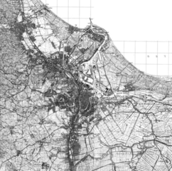
English: A 1920s map from a guide in the city of Danzig, officially Gdańsk since 1945. It was published in 1922-1928, the date is disputed. It has been archived on the metropolitan area's website, trojmiasto.pl. The link to the source is listed below.
Polski: Mapa z lat 20. XX wieku z przewodnika miejskiego miasta Danzig, oficjalnie Gdańsk od 1945. Mapa była opublikowana w latach od 1922-1928, data jest sporna. Została zarchiwizowana na stronie ośrodka metropolitalnego, trojmiasto.pl. Link do źródła na dole. |
| Date | 1922/1928 |
| Source | https://mapa.trojmiasto.pl/#/map/-19.41,210.96,0,h,0;1;24;37 |
| Author | Edward Carstenn |
Licensing
|
This work is in the public domain in its country of origin and other countries and areas where the copyright term is the author's life plus 70 years or fewer. This work is in the public domain in the United States because it was published (or registered with the U.S. Copyright Office) before January 1, 1929. | |
| This file has been identified as being free of known restrictions under copyright law, including all related and neighboring rights. | |
File history
Click on a date/time to view the file as it appeared at that time.
| Date/Time | Dimensions | User | Comment | |
|---|---|---|---|---|
| current | 02:47, 31 October 2021 | 861 × 853 (874 KB) | Luxtaythe2nd | Uploaded a work by Edward Carstenn from https://mapa.trojmiasto.pl/#/map/-19.41,210.96,0,h,0;1;24;37 with UploadWizard |
File usage
The following page uses this file: