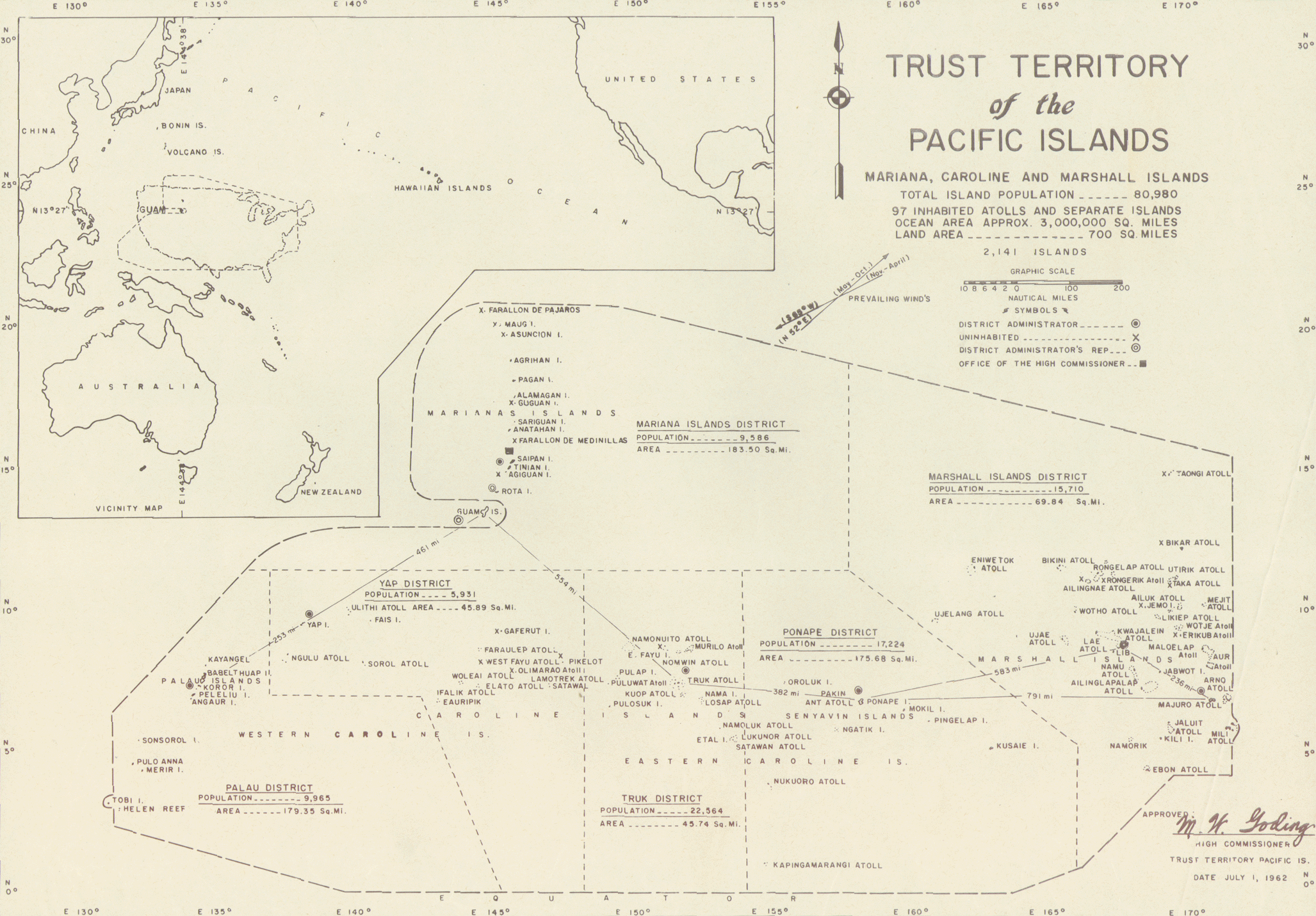
File:MapofTTPI.gif
Size of this preview: 800 × 557 pixels. Other resolutions: 320 × 223 pixels | 640 × 446 pixels | 1,024 × 713 pixels | 1,280 × 891 pixels | 2,055 × 1,431 pixels.
Original file (2,055 × 1,431 pixels, file size: 1.11 MB, MIME type: image/gif)
| This is a file from the Wikimedia Commons. The description on its description page there is shown below.
|

|
This map image could be re-created using vector graphics as an SVG file. This has several advantages; see Commons:Media for cleanup for more information. If an SVG form of this image is available, please upload it and afterwards replace this template with
{{vector version available|new image name}}.
It is recommended to name the SVG file “MapofTTPI.svg”—then the template Vector version available (or Vva) does not need the new image name parameter. |
Summary
![[1]](https://web.archive.org/web/20020605063920/http://libweb.hawaii.edu/ttp/images/1962full.gif)
Licensing
| This work is from the Library of Congress. According to the library, there are no known copyright restrictions on the use of this work. |  |
File history
Click on a date/time to view the file as it appeared at that time.
| Date/Time | Dimensions | User | Comment | |
|---|---|---|---|---|
| current | 16:20, 19 July 2010 | 2,055 × 1,431 (1.11 MB) | Beao | Removed border. |
File usage
The following page uses this file: