File:Mauke Aerial.jpg
Size of this preview: 623 × 600 pixels. Other resolutions: 249 × 240 pixels | 498 × 480 pixels | 812 × 782 pixels.
Original file (812 × 782 pixels, file size: 209 KB, MIME type: image/jpeg)
| This is a file from the Wikimedia Commons. The description on its description page there is shown below.
|
Summary
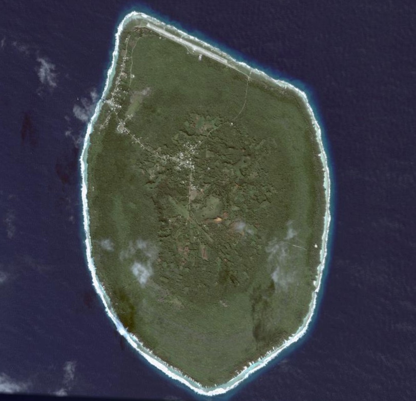
Satellite Image of Mauke, Cook Islands.
Licensing
| This file is in the public domain in the United States because it was solely created by NASA. NASA copyright policy states that "NASA material is not protected by copyright unless noted". (See Template:PD-USGov, NASA copyright policy page or JPL Image Use Policy.) | ||
 |
Warnings:
|
File history
Click on a date/time to view the file as it appeared at that time.
| Date/Time | Dimensions | User | Comment | |
|---|---|---|---|---|
| current | 23:28, 23 June 2007 | 812 × 782 (209 KB) | Aotearoa | Satellite Image of Mauke, Cook Islands. Category:Mauke Category:Satellite pictures of the Cook Islands ==Licensing== {{PD-USGov-NASA}} |
File usage
The following page uses this file: