File:Moheli island map-general view-fr.svg

Size of this PNG preview of this SVG file: 800 × 395 pixels. Other resolutions: 320 × 158 pixels | 640 × 316 pixels | 1,024 × 506 pixels | 1,280 × 633 pixels | 1,036 × 512 pixels.
Original file (SVG file, nominally 1,036 × 512 pixels, file size: 46 KB)
| This is a file from the Wikimedia Commons. The description on its description page there is shown below.
|
| Description |
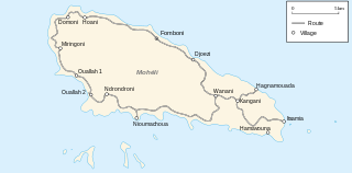
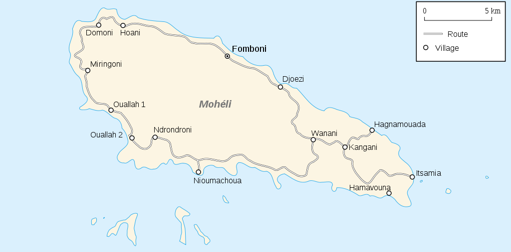
Français : Carte de l'île de Mohéli-Vue générale English: Mohéli Island general view Map |
||||||||
| Date | 07/08/2007 | ||||||||
| Source | Picture (non available on wiki) by Thierry Caro | ||||||||
| Author | historicair 23:16, 6 August 2007 (UTC) | ||||||||
| Permission (Reusing this file) |
I, the copyright holder of this work, hereby publish it under the following licenses:
This file is licensed under the Creative Commons Attribution-Share Alike 2.5 Generic, 2.0 Generic and 1.0 Generic license.
You may select the license of your choice. |
||||||||
| Other versions |
 , ,  , , |


|
This SVG file contains embedded text that can be translated into your language, using any capable SVG editor, text editor or the SVG Translate tool. For more information see: About translating SVG files. |
File history
Click on a date/time to view the file as it appeared at that time.
| Date/Time | Dimensions | User | Comment | |
|---|---|---|---|---|
| current | 16:16, 6 August 2007 | 1,036 × 512 (46 KB) | Historicair | {{Information |Description={{fr}}Carte de l'île de Mohéli-Vue générale{{en}}Mohéli Island general view Map |Source=Picture (non available on wiki) by Thierry Caro |Date=07/08/2007 |Author=~~~~ |Permission={{self2|GFDL |
File usage
The following page uses this file: