File:Mouth of the Yangtze 1754.jpg

Size of this preview: 800 × 552 pixels. Other resolutions: 320 × 221 pixels | 640 × 441 pixels | 1,024 × 706 pixels | 1,247 × 860 pixels.
Original file (1,247 × 860 pixels, file size: 161 KB, MIME type: image/jpeg)
| This is a file from the Wikimedia Commons. The description on its description page there is shown below.
|
Summary
| Description |
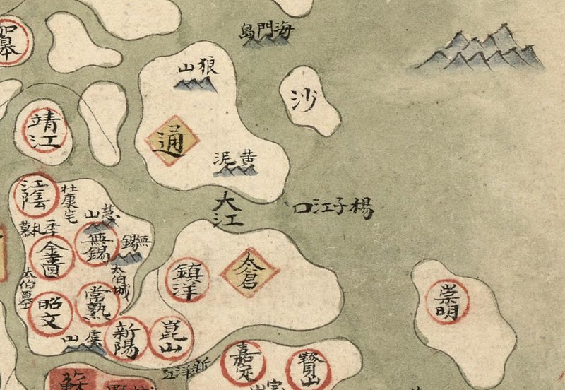
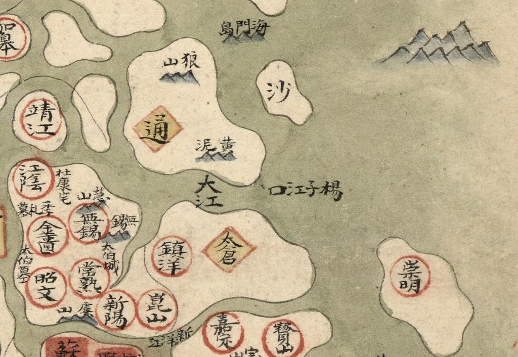
English: The mouth of the Yangtze River marked as such on the 8th Provincial Map of the 1754 Da Qing Fensheng Yutu, showing the Jiangnan Province of the Qing Empire during the reign of the Qianlong Emperor, now divided into the separate provinces of Shanghai, Jiangsu, and Anhui. Major cities, rivers, and mountains marked. Some islands and sandbars marked by mountains rising up out of the sea. Pen-and-ink and watercolor. Library of Congress copy, G2305 .D35 1782 Vault Shelf, G2305 .T15 17-- Vault.
中文:長江江口, 长江江口, Changjiang jiangkou, Ch'ang-chiang chiang-k'o. |
||
| Title | English: Provincial Atlas of the Qing Empire
中文:《大清分省輿圖》, Daqing Fensheng Yutu |
||
| Shelf ID | G2305 .D35 1760 | ||
| Parent | https://www.loc.gov/resource/g7820m.gct00229/ | ||
| Sheet title | English: Untitled
中文:無 |
||
| Date |
English: 1754
中文:乾隆十九年 |
||
| Source | LOC | ||
| Author | Unknown author | ||
| Permission (Reusing this file) |
|
||
| Other versions |
|
||
| Location | China · Jiangnan · Jiangsu · Yangtze River · Shanghai | ||
| Part of | American Memory · General Maps · Catalog · Geography And Map Division | ||
| Subject | Atlases · Early Maps · Maps · Early Works To 1800 · China · Administrative And Political Divisions · Manuscript Maps |


Licensing
|
This is a faithful photographic reproduction of a two-dimensional, public domain work of art. The work of art itself is in the public domain for the following reason:
The official position taken by the Wikimedia Foundation is that "faithful reproductions of two-dimensional public domain works of art are public domain".
This photographic reproduction is therefore also considered to be in the public domain in the United States. In other jurisdictions, re-use of this content may be restricted; see Reuse of PD-Art photographs for details. | ||||
| Annotations | This image is annotated: View the annotations at Commons |
File history
Click on a date/time to view the file as it appeared at that time.
| Date/Time | Dimensions | User | Comment | |
|---|---|---|---|---|
| current | 00:25, 25 March 2023 | 1,247 × 860 (161 KB) | LlywelynII | File:Da Qing fen sheng yu tu LOC 2002626726-9.jpg cropped using CropTool. |
File usage
The following page uses this file: