File:NPS yellowstone-map-2020.jpg

Size of this preview: 505 × 599 pixels. Other resolutions: 202 × 240 pixels | 405 × 480 pixels | 506 × 600 pixels | 647 × 768 pixels | 863 × 1,024 pixels | 3,000 × 3,558 pixels.
Original file (3,000 × 3,558 pixels, file size: 2.5 MB, MIME type: image/jpeg)
| This is a file from the Wikimedia Commons. The description on its description page there is shown below.
|
Summary
Summary
| Description |
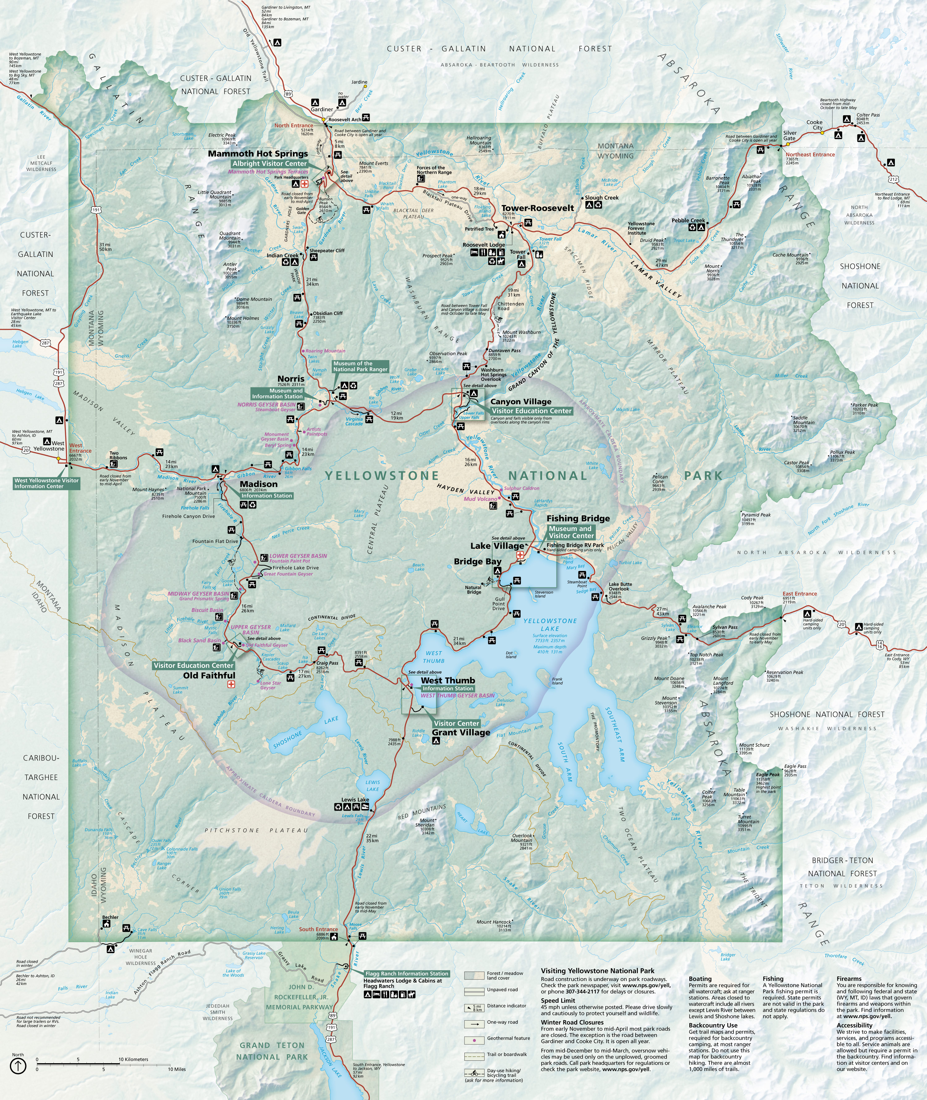
English: Main Yellowstone National Park map showing roads, attractions, lodging, and campgrounds throughout the entire park. |
| Date | |
| Source | U.S. National Park Service (http://npmaps.com/wp-content/uploads/yellowstone-national-park-map.jpg) |
| Author | U.S. National Park Service, restoration/cleanup by Matt Holly |
Licensing
| This image or media file contains material based on a work of a National Park Service employee, created as part of that person's official duties. As a work of the U.S. federal government, such work is in the public domain in the United States. See the NPS website and NPS copyright policy for more information. |
File history
Click on a date/time to view the file as it appeared at that time.
| Date/Time | Dimensions | User | Comment | |
|---|---|---|---|---|
| current | 13:08, 15 July 2022 | 3,000 × 3,558 (2.5 MB) | Ductwork | =={{int:filedesc}}== {{Information |description= {{en|1=Main Yellowstone National Park map showing roads, attractions, lodging, and campgrounds throughout the entire park.}} |date= 2020-07-17 |source= U.S. National Park Service (http://npmaps.com/wp-content/uploads/yellowstone-national-park-map.jpg) |author= {{Creator:NPS/Matt Holly}} |permission= |other versions= }} =={{int:license-header}}== {{NPS Maps}} Category:Maps of Yellowstone National Park |
File usage
The following page uses this file: