File:Narva basin map.svg

Size of this PNG preview of this SVG file: 423 × 599 pixels. Other resolutions: 169 × 240 pixels | 339 × 480 pixels | 423 × 600 pixels | 542 × 768 pixels | 722 × 1,024 pixels | 743 × 1,053 pixels.
Original file (SVG file, nominally 743 × 1,053 pixels, file size: 2.46 MB)
| This is a file from the Wikimedia Commons. The description on its description page there is shown below.
|
Summary
| Description |
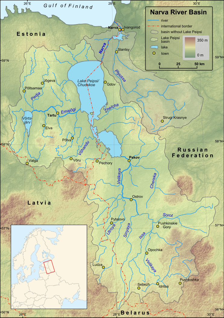
English: Map of Narva River and Lake Peipsi basins. Towns with population over 4000 (according to relevant Wikipedia lists) are included on the map. Terrain: embedded JPG. Projection: UTM Zone 35N |
| Date | |
| Source |
Created in ESRI ArcMap and Inkscape using a map from [1] and some other maps for corrections.
Elevation data from Shuttle Radar Topography Mission. |
| Author | Hannu |
| Other versions | Magyar |
Licensing
| I, the copyright holder of this work, release this work into the public domain. This applies worldwide. In some countries this may not be legally possible; if so: I grant anyone the right to use this work for any purpose, without any conditions, unless such conditions are required by law. |
File history
Click on a date/time to view the file as it appeared at that time.
| Date/Time | Dimensions | User | Comment | |
|---|---|---|---|---|
| current | 09:43, 1 December 2009 | 743 × 1,053 (2.46 MB) | Hannu~commonswiki | minor updates |
File usage
The following page uses this file: