File:Neeruti Tagajärv.jpg

Size of this preview: 800 × 329 pixels. Other resolutions: 320 × 132 pixels | 640 × 263 pixels | 1,024 × 421 pixels | 1,280 × 526 pixels | 7,747 × 3,186 pixels.
Original file (7,747 × 3,186 pixels, file size: 18.05 MB, MIME type: image/jpeg)
| This is a file from the Wikimedia Commons. The description on its description page there is shown below.
|
Summary
| Description |
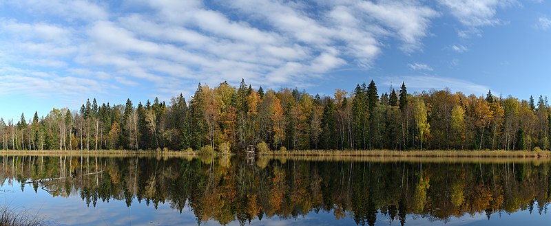
Eesti: Neeruti Tagajärv, Neeruti maastikukaitseala. Veepeegli pindala 3,3 ha, suurim sügavus 8,6 m. English: Lake Neeruti Tagajärv, Neeruti Landscape Reserve. Surface area 3.3 ha, deepness as far as 8.6 m. |
| Date | |
| Source | Own work |
| Author | Ivar Leidus |
| Camera location | | View this and other nearby images on: OpenStreetMap |
|---|
| Camera Model | Nikon D3100 |
|---|---|
| Shutter speed | 1/160; |
| Aperture | f/5.6; |
| Film speed (ISO) | 200; |
|

|
NOTE: This image is a panorama consisting of multiple frames that were merged or stitched in software. As a result, this image necessarily underwent some form of digital manipulation. These manipulations may include blending, blurring, cloning, and colour and perspective adjustments. As a result of these adjustments, the image content may be slightly different from reality at the points where multiple images were combined. This manipulation is often required due to lens, perspective, and parallax distortions.
|
This image was created with Hugin.
Licensing
I, the copyright holder of this work, hereby publish it under the following license:
This file is licensed under the Creative Commons Attribution-ShareAlike 3.0 Estonia license.
- You are free:
- to share – to copy, distribute and transmit the work
- to remix – to adapt the work
- Under the following conditions:
- attribution – You must give appropriate credit, provide a link to the license, and indicate if changes were made. You may do so in any reasonable manner, but not in any way that suggests the licensor endorses you or your use.
- share alike – If you remix, transform, or build upon the material, you must distribute your contributions under the same or compatible license as the original.

File history
Click on a date/time to view the file as it appeared at that time.
| Date/Time | Dimensions | User | Comment | |
|---|---|---|---|---|
| current | 11:41, 12 October 2012 | 7,747 × 3,186 (18.05 MB) | Iifar | User created page with UploadWizard |
File usage
The following 3 pages use this file: