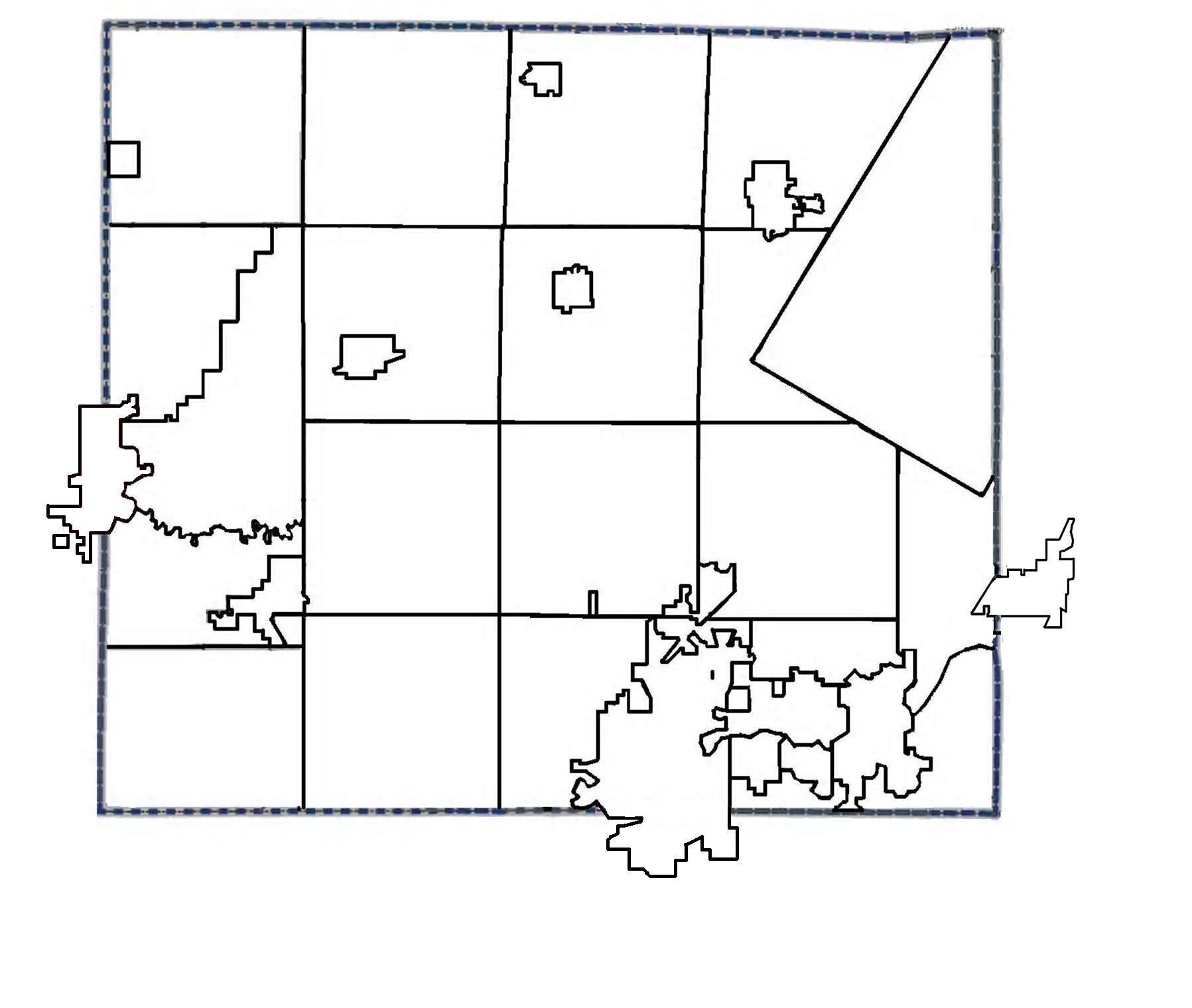
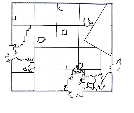
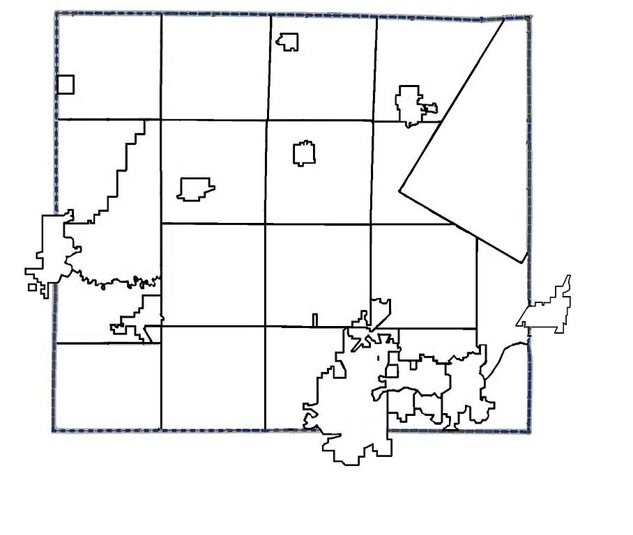
File:OutagamieCountyWisconsinMunicipalBoundaries.jpg
Size of this preview: 709 × 600 pixels. Other resolutions: 284 × 240 pixels | 568 × 480 pixels | 908 × 768 pixels | 1,211 × 1,024 pixels | 1,797 × 1,520 pixels.
Original file (1,797 × 1,520 pixels, file size: 138 KB, MIME type: image/jpeg)
| This is a file from the Wikimedia Commons. The description on its description page there is shown below.
|
Summary
| Description | |
| Date | |
| Source | Own work |
| Author | 1014cd |
Licensing
1014cd at English Wikipedia, the copyright holder of this work, hereby publishes it under the following license:
| This file is made available under the Creative Commons CC0 1.0 Universal Public Domain Dedication. | |
| The person who associated a work with this deed has dedicated the work to the public domain by waiving all of their rights to the work worldwide under copyright law, including all related and neighboring rights, to the extent allowed by law. You can copy, modify, distribute and perform the work, even for commercial purposes, all without asking permission.
|
Original upload log
The original description page was here. All following user names refer to en.wikipedia.
| Date/Time | Dimensions | User | Comment |
|---|---|---|---|
| 2011-08-20 18:27 | 1797×1520× (141616 bytes) | 1014cd | added municipalities that extend into two or more counties |
| 2011-08-19 18:55 | 1650×1275× (126856 bytes) | 1014cd | {{Information |Description={{en|1=Map of Muncicipality Boundaries in Outagamie County, Wisconsin}} |Source={{own}} |Author=[[User:1014cd|1014cd]] |Date=2011-19-8 |Permission= |other_versions= }} |
File history
Click on a date/time to view the file as it appeared at that time.
| Date/Time | Dimensions | User | Comment | |
|---|---|---|---|---|
| current | 11:20, 23 December 2014 | 1,797 × 1,520 (138 KB) | BD2412 | Transferred from en.wikipedia |
File usage
The following page uses this file: