File:Palazzo Bo (Padua).jpg

Original file(7,360 × 6,987 pixels, file size: 26.66 MB, MIME type: image/jpeg)

Commons-logo.svg This is a file from the Wikimedia Commons. The description on its description page there is shown below.
Commons is a freely licensed media file repository. You can help.

Summary

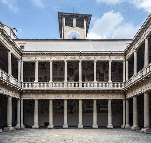
Palazzo Bo (Padua) Cortile Antico and the tower.

VI seal

This image has been assessed under the valued image criteria and is considered the most valued image on Commons within the scope: Palazzo Bo (Padua) courtyard and the tower.. You can see its nomination here.

Description
English: Padua university - Cortile Antico of Bo Palace and the tower in Padua.
Français : Université de Padoue - Le Cortile Antico du Palais Bo et la tour à Padoue.
Italiano: Università di Padova - Cortile Antico del Palazzo del Bo e Torre del Bo in Padova.
Date Taken on 1 June 2016
Source Own work
Author Didier Descouens
Permission
(Reusing this file)
This file is copyrighted and has been released under a license which is incompatible with Facebook's licensing terms. It is not permitted to upload this file at Facebook.
I, the copyright holder of this work, hereby publish it under the following license:
w:en:Creative Commons
attribution share alike
This file is licensed under the Creative Commons Attribution-Share Alike 4.0 International license.
You are free:
  • to share – to copy, distribute and transmit the work
  • to remix – to adapt the work
Under the following conditions:
  • attribution – You must give appropriate credit, provide a link to the license, and indicate if changes were made. You may do so in any reasonable manner, but not in any way that suggests the licensor endorses you or your use.
  • share alike – If you remix, transform, or build upon the material, you must distribute your contributions under the same or compatible license as the original.
Camera location45° 24′ 24.86″ N, 11° 52′ 38.28″ E Kartographer map based on OpenStreetMap.View this and other nearby images on: OpenStreetMapinfo

Captions

Add a one-line explanation of what this file represents

Items portrayed in this file

depicts

1 June 2016

45°24'24.858"N, 11°52'38.276"E

File history

Click on a date/time to view the file as it appeared at that time.

Date/TimeDimensionsUserComment
current22:36, 5 April 20177,360 × 6,987 (26.66 MB)Archaeodontosaurus{{Information |Description ={{en|1=v}} |Source ={{own}} |Author =Archaeodontosaurus |Date = |Permission = |other_versions = }}

The following page uses this file:

Metadata