File:Palestine 1020BC Smith 1915.jpg

Size of this preview: 374 × 600 pixels. Other resolutions: 150 × 240 pixels | 299 × 480 pixels | 479 × 768 pixels | 639 × 1,024 pixels | 2,424 × 3,886 pixels.
Original file (2,424 × 3,886 pixels, file size: 6.59 MB, MIME type: image/jpeg)
| This is a file from the Wikimedia Commons. The description on its description page there is shown below.
|
Summary
| Description |
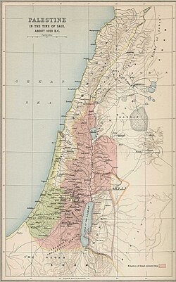
English: Palestine 1020BC; Atlas of the Historical Geography of the Holy Land by George Adam Smith in 1915
العربية: فلسطين في عام 1020 ق.م؛ من الأطلس الذي أعده جورج آدم سميث في عام 1915 لتاريخ جغرافيا الأرض المقدسة. |
| Date | |
| Source | |
| Author | George Adam Smith |
.jpg)
Licensing
This media file is in the public domain in the United States. This applies to U.S. works where the copyright has expired, often because its first publication occurred prior to January 1, 1930, and if not then due to lack of notice or renewal. See this page for further explanation.
|
 | |
 |
File history
Click on a date/time to view the file as it appeared at that time.
| Date/Time | Dimensions | User | Comment | |
|---|---|---|---|---|
| current | 00:18, 24 December 2023 | 2,424 × 3,886 (6.59 MB) | DEGA MD | Higher resolution version of the same map. |
File usage
The following page uses this file: