File:PassaicRiverNorthBend.png
Size of this preview: 401 × 599 pixels. Other resolutions: 161 × 240 pixels | 474 × 708 pixels.
Original file (474 × 708 pixels, file size: 101 KB, MIME type: image/png)
| This is a file from the Wikimedia Commons. The description on its description page there is shown below.
|
Summary
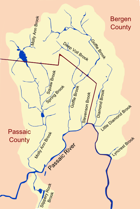
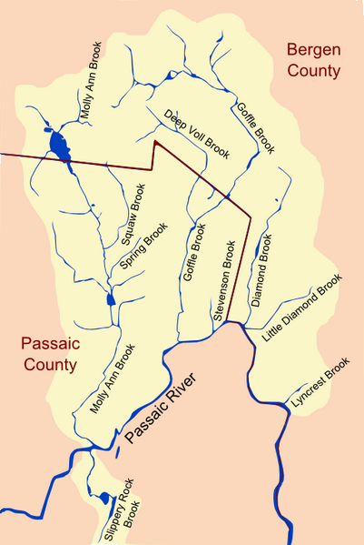
-Major Tributaries of the North Bend of the Passaic River- (Image Width ~4.25 mi) From west to east: w:Slippery Rock Brook, w:Molly Ann Brook, w:Squaw Brook, w:Deep Voll Brook, w:Goffle Brook, w:Stevenson Brook, w:Diamond Brook, w:Little Diamond Brook, and w:Lyncrest Brook
Image created by tracing streams on aerial imagery with assistance of local maps. Original file created as a scaled vector image and exported as a portable network graphic. Some post editing done in Inkscape to smooth rough lines.
Licensing
| I, the copyright holder of this work, release this work into the public domain. This applies worldwide. In some countries this may not be legally possible; if so: I grant anyone the right to use this work for any purpose, without any conditions, unless such conditions are required by law. |
File history
Click on a date/time to view the file as it appeared at that time.
| Date/Time | Dimensions | User | Comment | |
|---|---|---|---|---|
| current | 21:15, 3 February 2009 | 474 × 708 (101 KB) | Lithium6ion | -Major Tributaries of the North Bend of the Passaic River- (Image Width ~4.25 mi) From west to east: Slippery Rock Brook, Molly Ann Brook, Squaw Brook, Deep Voll Brook, Goffle Brook, Diamond Brook, Little Diamond Brook, and [[L |
File usage
The following page uses this file: