File:Peat (49302157252).jpg

Size of this preview: 800 × 600 pixels. Other resolutions: 320 × 240 pixels | 640 × 480 pixels | 1,024 × 768 pixels.
Original file (1,024 × 768 pixels, file size: 197 KB, MIME type: image/jpeg)
| This is a file from the Wikimedia Commons. The description on its description page there is shown below.
|
.jpg)
Summary
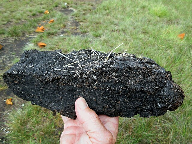
| Description | Peat (also known as turf) consists of partially decayed organic matter. The Irish have long mined peat to be burned as fuel though this practice is now discouraged for environmental reasons. |
| Date | |
| Source | Peat |
| Author | David Stanley from Nanaimo, Canada |
| Camera location | | View this and other nearby images on: OpenStreetMap |
|---|
.jpg¶ms=053.579917_N_-009.786361_E_globe:Earth_type:camera_source:Flickr_&language=en)
Licensing
This file is licensed under the Creative Commons Attribution 2.0 Generic license.
- You are free:
- to share – to copy, distribute and transmit the work
- to remix – to adapt the work
- Under the following conditions:
- attribution – You must give appropriate credit, provide a link to the license, and indicate if changes were made. You may do so in any reasonable manner, but not in any way that suggests the licensor endorses you or your use.
| This image was originally posted to Flickr by D-Stanley at https://flickr.com/photos/79721788@N00/49302157252. It was reviewed on 24 November 2020 by FlickreviewR 2 and was confirmed to be licensed under the terms of the cc-by-2.0. |
File history
Click on a date/time to view the file as it appeared at that time.
| Date/Time | Dimensions | User | Comment | |
|---|---|---|---|---|
| current | 19:42, 23 November 2020 | 1,024 × 768 (197 KB) | Matlin | Transferred from Flickr via #flickr2commons |
File usage
The following page uses this file:
.jpg)