File:Pedra Branca Map.svg

Size of this PNG preview of this SVG file: 800 × 487 pixels. Other resolutions: 320 × 195 pixels | 640 × 390 pixels | 1,024 × 624 pixels | 1,280 × 779 pixels | 3,478 × 2,118 pixels.
Original file (SVG file, nominally 3,478 × 2,118 pixels, file size: 230 KB)
| This is a file from the Wikimedia Commons. The description on its description page there is shown below.
|
Summary
| Description |
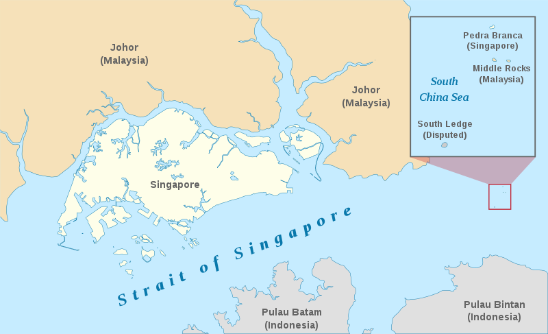
English: A map showing the approximate location of the island of Pedra Branca, which is under the sovereignty of Singapore, at the eastern end of the Singapore Strait where it meets the South China Sea. Near it are the maritime features Middle Rocks (under Malaysian sovereignty) and South Ledge, and the coasts of Johor, Malaysia, and Bintan, Indonesia. |
| Date | |
| Source | Self-made, modified from Image:Singapore Outline.svg. |
| Author | Jappalang. |
| Permission (Reusing this file) |
PD-Self. |
This W3C-unspecified vector image was created with Inkscape .
Licensing
| I, the copyright holder of this work, release this work into the public domain. This applies worldwide. In some countries this may not be legally possible; if so: I grant anyone the right to use this work for any purpose, without any conditions, unless such conditions are required by law. |
File history
Click on a date/time to view the file as it appeared at that time.
| Date/Time | Dimensions | User | Comment | |
|---|---|---|---|---|
| current | 23:27, 12 January 2021 | 3,478 × 2,118 (230 KB) | Seloloving | recoloured to Wikipedia map colour style |
File usage
The following page uses this file: