File:Pisum sativum MHNT.BOT.2010.12.9.jpg
Size of this preview: 800 × 523 pixels. Other resolutions: 320 × 209 pixels | 640 × 418 pixels | 1,024 × 669 pixels | 1,280 × 837 pixels | 4,962 × 3,244 pixels.
Original file (4,962 × 3,244 pixels, file size: 3.84 MB, MIME type: image/jpeg)
| This is a file from the Wikimedia Commons. The description on its description page there is shown below.
|
|
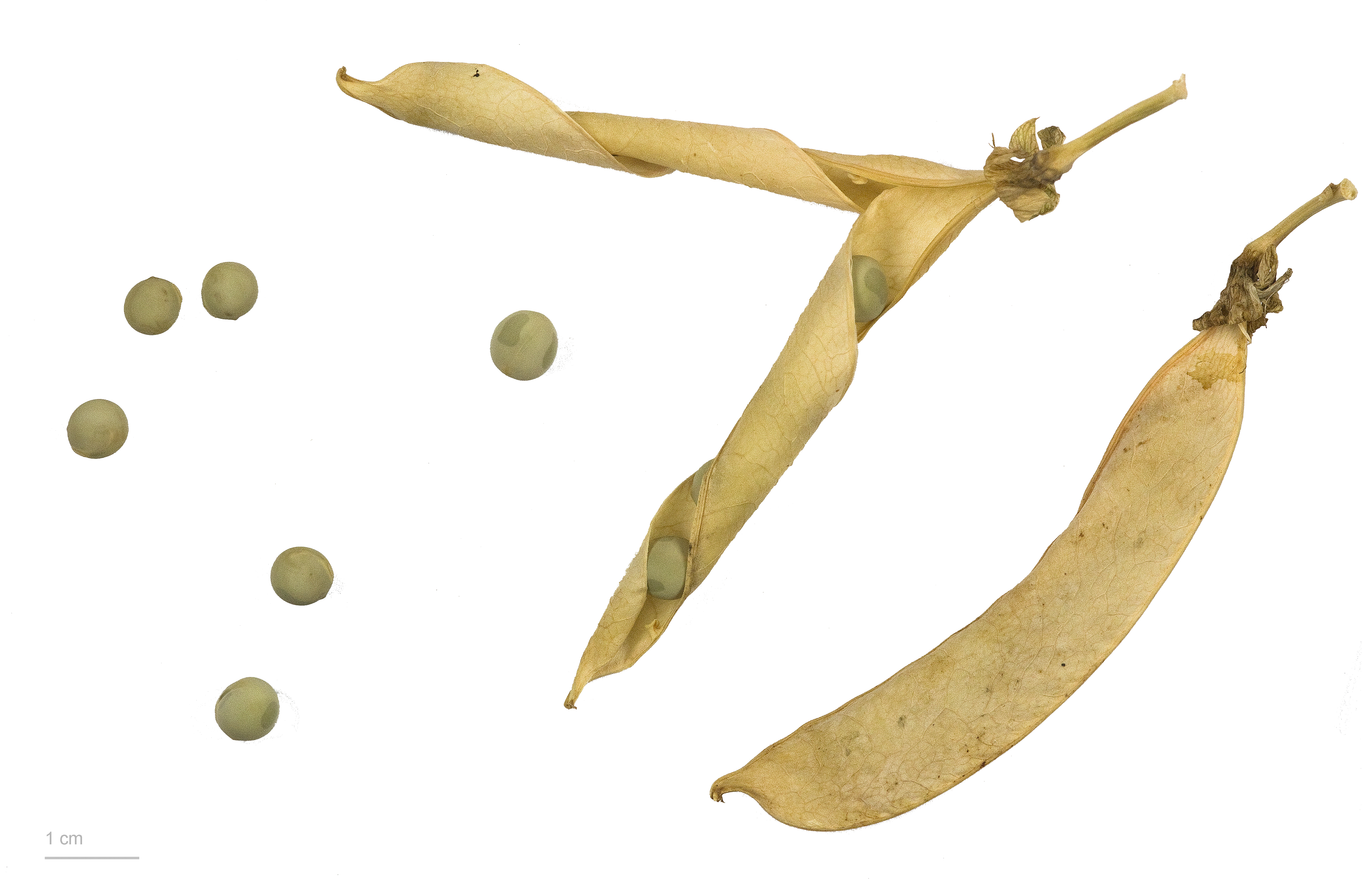
Pisum sativum L., 1753 |
| Photographer | ||||||||||||||||||||||||
| Description |
|
|||||||||||||||||||||||
| Place of discovery | Deutsch: Verbreitung : AAus dem Nahen Osten (Fruchtbarer Halbmond). Provenienz : botanischer garten Henri Gaussen. English: Distribution : From the Middle East (Fertile Crescent). Provenance : botanical garden Henri Gaussen. Français : Répartition : Originaire du Moyen Orient. Provenance : Jardin botanique Henri Gaussen |
|||||||||||||||||||||||
| Date | 17 July 2013 | |||||||||||||||||||||||
| Collection |
|
|||||||||||||||||||||||
| Accession number |
MHNT.BOT.2010.12.9 |
|||||||||||||||||||||||
| Source | Own work | |||||||||||||||||||||||
| Permission (Reusing this file) |
I, the copyright holder of this work, hereby publish it under the following license: This file is licensed under the Creative Commons Attribution-Share Alike 3.0 Unported license.
|
|||||||||||||||||||||||

| Camera location | | View this and other nearby images on: OpenStreetMap |
|---|

|
This document was made as part of the Projet Phoebus.
|

|
This image has been assessed under the valued image criteria and is considered the most valued image on Commons within the scope: Pisum sativum (Pea), fruits and seeds. You can see its nomination here. |
File history
Click on a date/time to view the file as it appeared at that time.
| Date/Time | Dimensions | User | Comment | |
|---|---|---|---|---|
| current | 06:57, 8 October 2013 | 4,962 × 3,244 (3.84 MB) | Ercé | {{Information |Description ={{en|1=x}} |Source ={{own}} |Author =Ercé |Date = |Permission = |other_versions = }} |
File usage
The following page uses this file: