File:Plaque Traité de Paris, 56 rue Jacob, Paris 6.jpg
Size of this preview: 520 × 599 pixels. Other resolutions: 208 × 240 pixels | 416 × 480 pixels | 521 × 600 pixels | 666 × 768 pixels | 889 × 1,024 pixels | 1,727 × 1,990 pixels.
Original file (1,727 × 1,990 pixels, file size: 3.04 MB, MIME type: image/jpeg)
| This is a file from the Wikimedia Commons. The description on its description page there is shown below.
|
Summary
| Description |
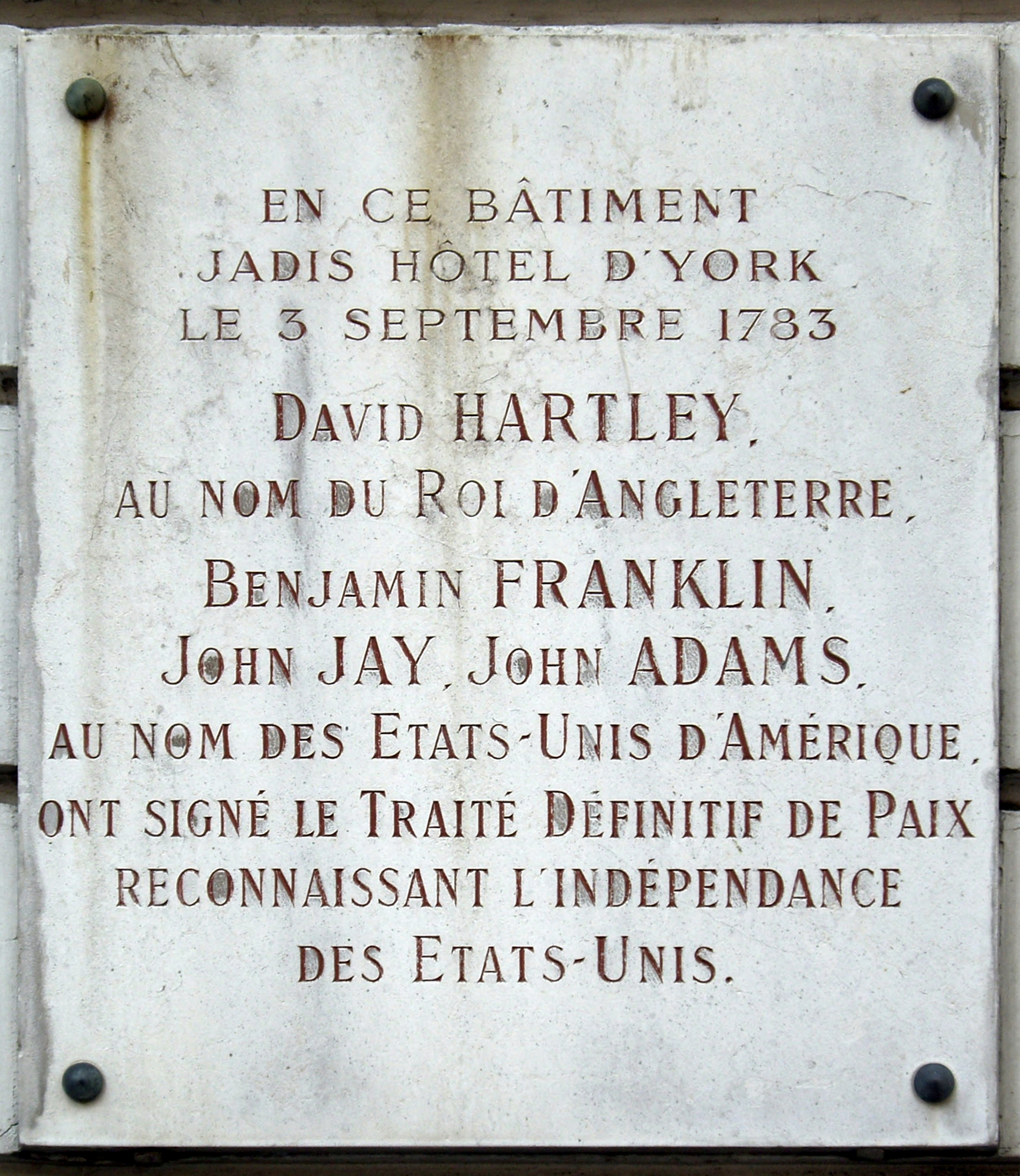
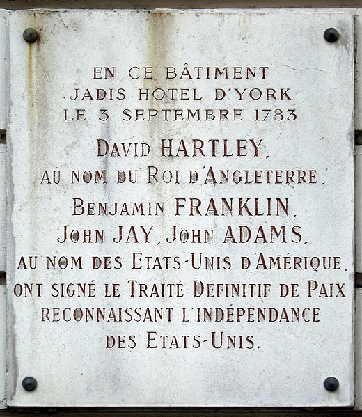
Français : Plaque commémorative du traité de Paris, fixé à l'immeuble de la rue Jacob (N° 56) ou fut signé le traité.
Texte: En ce bâtiment, jadis Hôtel d'York, le 3 Septembre 1783 David Hartly, au nom du Roi d'Angleterre, Benjamin Franklin, John Jay, John Adams, au nom de Etats-Unis d'Amerique, ont signé le Traité Définitif de Paix reconnaissant l'independance des Etats-Unis. English: Commemorative plaque of the treaty of Paris, affixed on the building of rue Jacob (N° 56) where the treaty was signed. Text: In this building, once Hotel of York, on September 3, 1783, David Hartly, in the name of the King of England, Benjamin Franklin, John Jay, John Adams, in the name of the United States of America, signed the Definite Peace Treaty recognising the independence of the United States. |
| Date | |
| Source | Own work |
| Author | Wikimedia Commons / Mu |
| Camera location | | View this and other nearby images on: OpenStreetMap |
|---|
Licensing
This file is licensed under the Creative Commons Attribution-Share Alike 3.0 Unported license.
- You are free:
- to share – to copy, distribute and transmit the work
- to remix – to adapt the work
- Under the following conditions:
- attribution – You must give appropriate credit, provide a link to the license, and indicate if changes were made. You may do so in any reasonable manner, but not in any way that suggests the licensor endorses you or your use.
- share alike – If you remix, transform, or build upon the material, you must distribute your contributions under the same or compatible license as the original.
File history
Click on a date/time to view the file as it appeared at that time.
| Date/Time | Dimensions | User | Comment | |
|---|---|---|---|---|
| current | 12:58, 10 December 2012 | 1,727 × 1,990 (3.04 MB) | Paris 16 |
File usage
The following page uses this file: