File:Plymouth siege map 1643.gif

Original file (4,075 × 2,921 pixels, file size: 1.21 MB, MIME type: image/gif)
| This is a file from the Wikimedia Commons. The description on its description page there is shown below.
|
Summary
| Description |
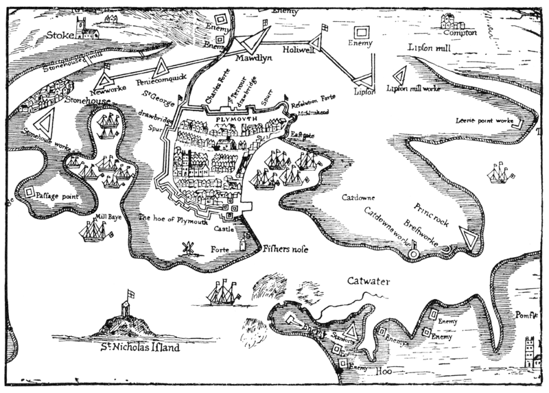
English: Part of "A True Mapp and Description of the Towne of Plymouth and the Fortifications thereof at the last siege, A. 1643" |
| Date | 17th century, after 1643. |
| Source | A 17th century map, reproduced in Bracken: A History of Plymouth, 1931, opp. p126. |
| Author | Original author unknown, fl 17th century. Scanned by me 2008-07-05. |
Licensing
|
This work is in the public domain in its country of origin and other countries and areas where the copyright term is the author's life plus 70 years or fewer.
| |
| This file has been identified as being free of known restrictions under copyright law, including all related and neighboring rights. | |
File history
Click on a date/time to view the file as it appeared at that time.
| Date/Time | Dimensions | User | Comment | |
|---|---|---|---|---|
| current | 16:06, 5 July 2008 | 4,075 × 2,921 (1.21 MB) | Smalljim | {{Information |Description={{en|1=Part of "A True Mapp and Description of the Towne of Plymouth and the Fortifications thereof at the last siege, A. 1643"}} |Source=A 17th century map, reproduced in Bracken: A History of Plymouth, 1931, opp. p126. |Author |
File usage
The following page uses this file: