File:Rhodes NLT Landsat7.png
Size of this preview: 605 × 600 pixels. Other resolutions: 242 × 240 pixels | 484 × 480 pixels | 775 × 768 pixels | 1,033 × 1,024 pixels | 1,948 × 1,931 pixels.
Original file (1,948 × 1,931 pixels, file size: 5.65 MB, MIME type: image/png)
| This is a file from the Wikimedia Commons. The description on its description page there is shown below.
|
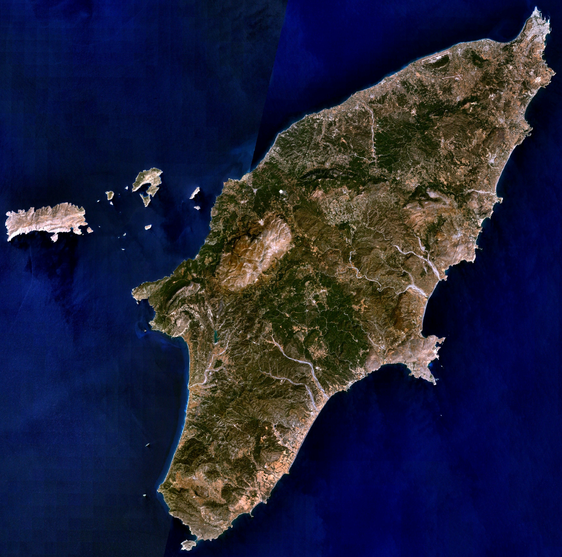
| Description | Visible colour satellite image of Rhodes. | |||
| Source |
Screenshot from NASA World Wind, NLT Landsat7 layer. Coordinates: worldwind://goto/world=Earth&lat=36.16654&lon=27.93315&alt=80698 |
|||
| Author | Photograph: NASA | |||
| Permission (Reusing this file) |
|
|||
| Other versions | Image:Rodas.png |

File history
Click on a date/time to view the file as it appeared at that time.
| Date/Time | Dimensions | User | Comment | |
|---|---|---|---|---|
| current | 12:29, 16 April 2006 | 1,948 × 1,931 (5.65 MB) | Hautala | {{Information| |Description=Visible colour satellite image of Rhodes. |Source=Screenshot from NASA World Wind, NLT Landsat7 layer. |Date= |Author= |Permission={{PD-WorldWind}} |other_versions= }} |
File usage
The following page uses this file: