File:Romanbritain.jpg
Size of this preview: 375 × 599 pixels. Other resolutions: 150 × 240 pixels | 300 × 480 pixels | 375 × 600 pixels | 854 × 1,364 pixels.
Original file (854 × 1,364 pixels, file size: 712 KB, MIME type: image/jpeg)
| This is a file from the Wikimedia Commons. The description on its description page there is shown below.
|

|
This old map image could be re-created using vector graphics as an SVG file. This has several advantages; see Commons:Media for cleanup for more information. If an SVG form of this image is available, please upload it and afterwards replace this template with
{{vector version available|new image name}}.
It is recommended to name the SVG file “Romanbritain.svg”—then the template Vector version available (or Vva) does not need the new image name parameter. |


Summary
| Description |
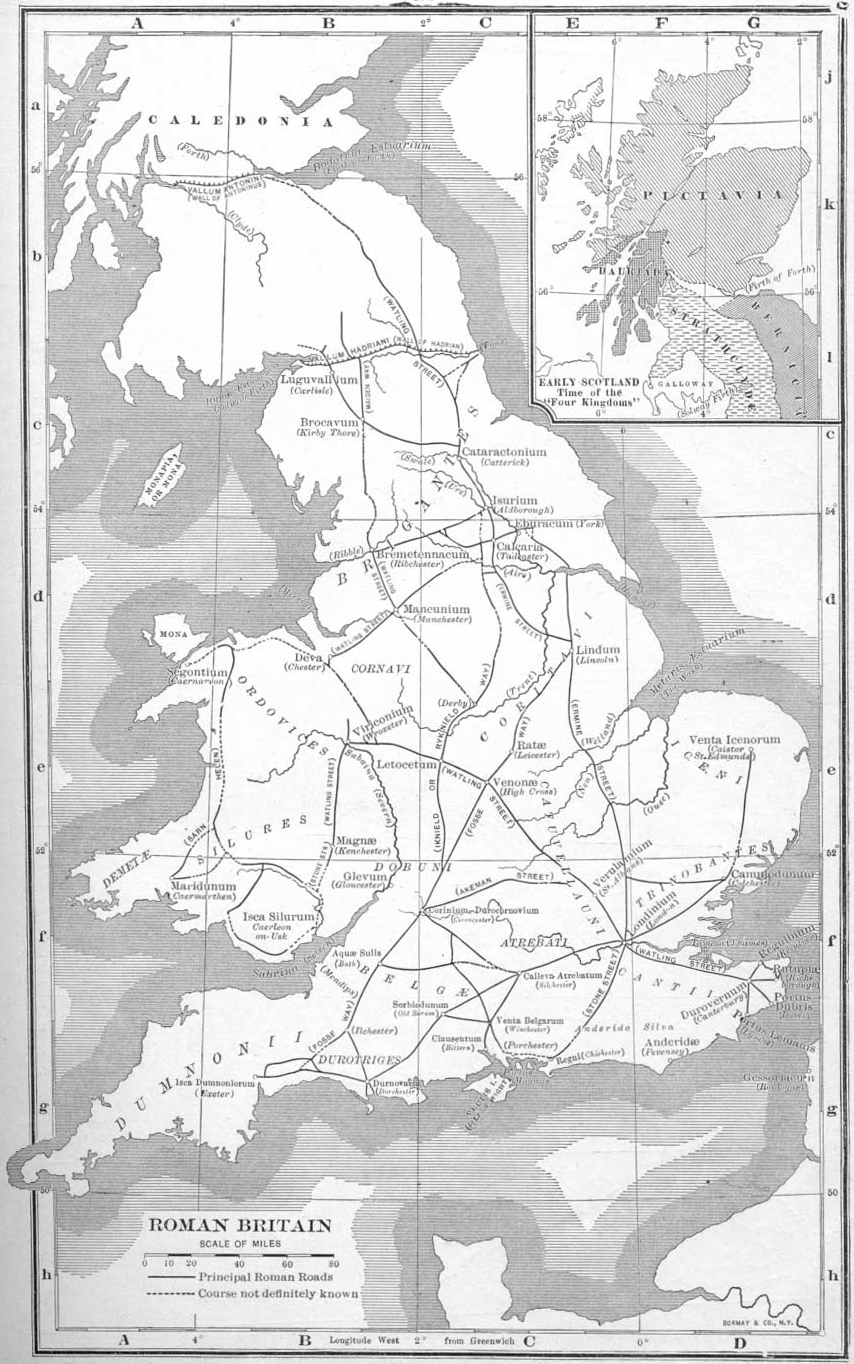
English: An outdated map of the Roman road network in Britain |
||||
| Date | |||||
| Source | Atlas of European History, London: G. Bell & Sons, 1910 | ||||
| Author | Earle W. Dowe; uploaded to English Wikipedia 22:04, 1 April 2005 by Adamsan | ||||
| Permission (Reusing this file) |
|
||||
| Other versions |
|
||||


File history
Click on a date/time to view the file as it appeared at that time.
| Date/Time | Dimensions | User | Comment | |
|---|---|---|---|---|
| current | 07:33, 11 September 2011 | 854 × 1,364 (712 KB) | Gauravjuvekar | rotated |
File usage
The following page uses this file: