File:Rosendale trestle postcard.jpg

Size of this preview: 800 × 507 pixels. Other resolutions: 320 × 203 pixels | 640 × 406 pixels | 1,024 × 650 pixels | 1,280 × 812 pixels | 4,417 × 2,802 pixels.
Original file (4,417 × 2,802 pixels, file size: 3.07 MB, MIME type: image/jpeg)
| This is a file from the Wikimedia Commons. The description on its description page there is shown below.
|
Summary
| Description |
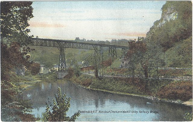
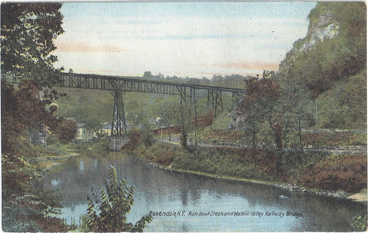
English: Scan of a postcard of the Rosendale railroad trestle and Rondout Creek in Rosendale, New York. The area under the trestle was known as "Dead Man's Curve". |
| Date | early 20th century |
| Source | Postcard from Rosendale Library, please attribute the library if reusing this work. |
| Author | Unknown author |
Licensing
This media file is in the public domain in the United States. This applies to U.S. works where the copyright has expired, often because its first publication occurred prior to January 1, 1929, and if not then due to lack of notice or renewal. See this page for further explanation.
|
 | |
 |
This image might not be in the public domain outside of the United States; this especially applies in the countries and areas that do not apply the rule of the shorter term for US works, such as Canada, Mainland China (not Hong Kong or Macao), Germany, Mexico, and Switzerland. The creator and year of publication are essential information and must be provided. See Wikipedia:Public domain and Wikipedia:Copyrights for more details.
|
File history
Click on a date/time to view the file as it appeared at that time.
| Date/Time | Dimensions | User | Comment | |
|---|---|---|---|---|
| current | 17:12, 10 February 2011 | 4,417 × 2,802 (3.07 MB) | Gyrobo | {{Information |Description ={{en|1=Scan of a postcard of the Rosendale railroad trestle and Rondout Creek in Rosendale, New York. The area under the trestle was known as "Dead Man's Curve".}} |Source =Postcard from Rosendale Library |Author |
File usage
The following page uses this file: