File:SCO Map.png
No higher resolution available.
SCO_Map.png (600 × 600 pixels, file size: 139 KB, MIME type: image/png)
| This is a file from the Wikimedia Commons. The description on its description page there is shown below.
|

|
File:SCO (orthographic projection).svg is a vector version of this file. It should be used in place of this PNG file when not inferior.
File:SCO Map.png → File:SCO (orthographic projection).svg
For more information, see Help:SVG. |
.svg) |
| Description |
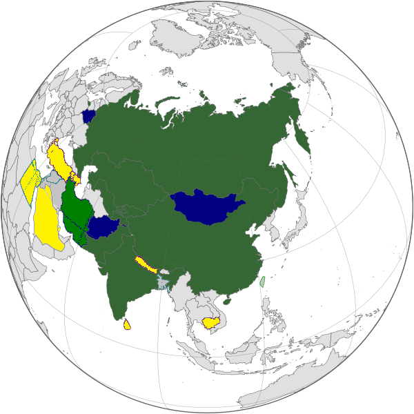
English: Map of the Shanghai Cooperation Organization.
Strict definition - Member states Broad definition: Chinese disputed territories, Observer states, Dialogue Partners Русский: Карта Шанхайской Организации Сотрудничества. Строгое определение - страны члены Широкое определение: Китайские спорные территории, страны наблюдатели, партнеры по диалогу |
||||||||
| Date | 12 April 2005, updated on 20 June 2009 | ||||||||
| Source | |||||||||
| Author | Aris Katsaris, updated by Emilfaro | ||||||||
| Permission (Reusing this file) |
|

File history
Click on a date/time to view the file as it appeared at that time.
| Date/Time | Dimensions | User | Comment | |
|---|---|---|---|---|
| current | 00:22, 20 September 2022 | 600 × 600 (139 KB) | Yuri V. | correct version, without errors |
File usage
The following page uses this file: