File:School districts in Hamilton County, Ohio.png
Size of this preview: 798 × 600 pixels. Other resolutions: 320 × 240 pixels | 639 × 480 pixels | 1,022 × 768 pixels | 1,280 × 962 pixels | 2,578 × 1,937 pixels.
Original file (2,578 × 1,937 pixels, file size: 804 KB, MIME type: image/png)
| This is a file from the Wikimedia Commons. The description on its description page there is shown below.
|
Summary
| Description |
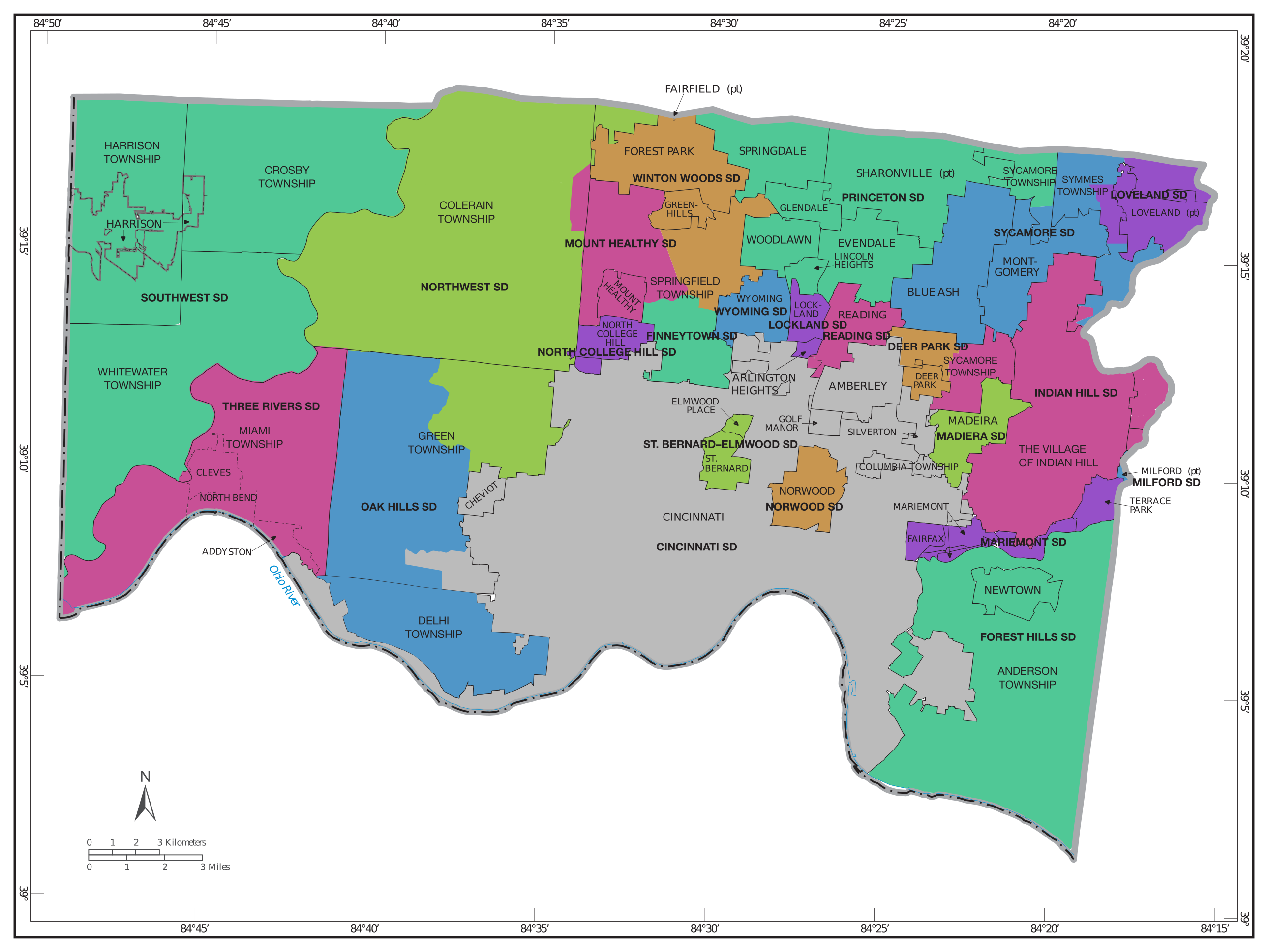
English: A map of school districts in Hamilton County, Ohio, which contains the city of Cincinnati. School districts are shown in colors, with the name in bold capitals. Municipal and township borders are shown and labeled. Some school district borders are approximate. |
| Date | |
| Source | Adapted from Geographic Areas Reference Map for Ohio, p. E19, using information from [1] |
| Author | U.S. Census Bureau, with modifications by User:Antony-22 |
| Other versions | File:School districts in Hamilton County, Ohio.svg - SVG version |
Licensing
This file is licensed under the Creative Commons Attribution-Share Alike 4.0 International license.
- You are free:
- to share – to copy, distribute and transmit the work
- to remix – to adapt the work
- Under the following conditions:
- attribution – You must give appropriate credit, provide a link to the license, and indicate if changes were made. You may do so in any reasonable manner, but not in any way that suggests the licensor endorses you or your use.
- share alike – If you remix, transform, or build upon the material, you must distribute your contributions under the same or compatible license as the original.
File history
Click on a date/time to view the file as it appeared at that time.
| Date/Time | Dimensions | User | Comment | |
|---|---|---|---|---|
| current | 15:11, 4 December 2021 | 2,578 × 1,937 (804 KB) | Antony-22 | tweaks |
File usage
The following page uses this file: