File:Sierra Nevada map.png
No higher resolution available.
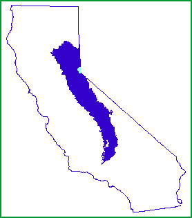
Sierra_Nevada_map.png (278 × 315 pixels, file size: 5 KB, MIME type: image/png)
| This is a file from the Wikimedia Commons. The description on its description page there is shown below.
|

|
File:Sierra Nevada map vector.svg is a vector version of this file. It should be used in place of this PNG file when not inferior.
File:Sierra Nevada map.png → File:Sierra Nevada map vector.svg
For more information, see Help:SVG. |
 |
Summary
| Description | |
| Date | |
| Source | http://www.fs.fed.us/r5/spf/publications/fh_94-95/m261e.htm |
| Author | John W. Dale, U.S. Forest Service |
| Permission (Reusing this file) |
Public Domain |
Licensing
This image is a work of the Forest Service of the United States Department of Agriculture. As a work of the U.S. federal government, the image is in the public domain.
|
File history
Click on a date/time to view the file as it appeared at that time.
| Date/Time | Dimensions | User | Comment | |
|---|---|---|---|---|
| current | 16:21, 7 January 2007 | 278 × 315 (5 KB) | Hike395 | {{Information |Description=Map of the Sierra Nevada, United States |Source=http://www.fs.fed.us/r5/spf/publications/fh_94-95/m261e.htm |Date=1999-07-12 |Author=John W. Dale, U.S. Forest Service |Permission=Public Domain }} |
File usage
The following page uses this file: