File:Smith County Texas Incorporated Areas Tyler highlighted.svg

Size of this PNG preview of this SVG file: 799 × 387 pixels. Other resolutions: 320 × 155 pixels | 640 × 310 pixels | 1,024 × 496 pixels | 1,280 × 620 pixels | 1,055 × 511 pixels.
Original file (SVG file, nominally 1,055 × 511 pixels, file size: 587 KB)
| This is a file from the Wikimedia Commons. The description on its description page there is shown below.
|
Summary
| Description |
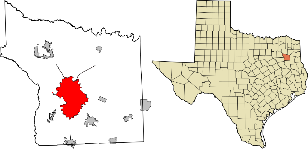
English: This map shows the incorporated areas in Smith County, Texas. Tyler is highlighted in red. I created it using GIS data from the City of Tyler. |
| Date | |
| Source | Own work |
| Author | Jrduke |
Public Domain
Licensing
| I, the copyright holder of this work, release this work into the public domain. This applies worldwide. In some countries this may not be legally possible; if so: I grant anyone the right to use this work for any purpose, without any conditions, unless such conditions are required by law. |
File history
Click on a date/time to view the file as it appeared at that time.
| Date/Time | Dimensions | User | Comment | |
|---|---|---|---|---|
| current | 10:10, 28 September 2010 | 1,055 × 511 (587 KB) | Jrduke~commonswiki | {{Information |Description={{en|1=This map shows the incorporated areas in Smith County, Texas. Tyler is highlighted in red. I created it using GIS data from the [http://www.smithcountymapsite.org/webshare/data.htm Ci |
File usage
The following page uses this file: