File:St Andrews - 'The Prospect of the Town of St Andrews' (5372742538).jpg

Original file (5,246 × 3,373 pixels, file size: 4.36 MB, MIME type: image/jpeg)
| This is a file from the Wikimedia Commons. The description on its description page there is shown below.
|
.jpg)
Summary
| Description |
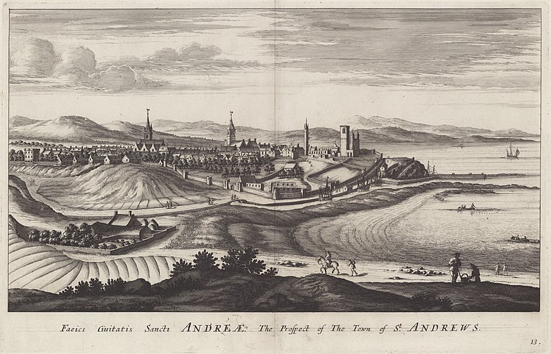
English: This view shows the south side of St Andrews, with the mouth of the River Eden in the distance, and ships anchored off the harbour. Inside the city walls the buildings dominating the town are, from right: the tower and ruins of St Andrews Cathedral; the tower of the Church of St Rule; the tower of St Salvator's College; and Holy Trinity Church, the town's parish church. As well as a horseman with armed guard on the road, you can see in the foreground people at work and play. The scale of this image isn't quite accurate: compare the size of the figures on the path by the river to the sailing ship to the right of centre. On the left is what could be a walled farm building. There are scenes of fishing from boats, and evidence of fields that have been farmed. |
| Date | |
| Source | https://www.flickr.com/photos/nlscotland/5372742538/ |
| Author | National Library of Scotland |
| Permission (Reusing this file) |
At the time of upload, the image license was automatically confirmed using the Flickr API. For more information see Flickr API detail. |
| Flickr sets |
|
| Flickr tags |
|
| Camera location | | View this and other nearby images on: OpenStreetMap |
|---|
.jpg¶ms=056.339309_N_-002.796190_E_globe:Earth_type:camera__&language=en)
Licensing
This image was taken from Flickr's The Commons. The uploading organization may have various reasons for determining that no known copyright restrictions exist, such as:
More information can be found at https://flickr.com/commons/usage/. Please add additional copyright tags to this image if more specific information about copyright status can be determined. See Commons:Licensing for more information. |
| This image was originally posted to Flickr by National Library of Scotland at https://flickr.com/photos/14456531@N07/5372742538. It was reviewed on 16 November 2016 by FlickreviewR and was confirmed to be licensed under the terms of the No known copyright restrictions. |
File history
Click on a date/time to view the file as it appeared at that time.
| Date/Time | Dimensions | User | Comment | |
|---|---|---|---|---|
| current | 14:01, 19 January 2022 | 5,246 × 3,373 (4.36 MB) | Ich | Cropped 13 % horizontally, 34 % vertically using CropTool with lossless mode. |
File usage
The following page uses this file:
.jpg)