File:Stepney Met. B Ward Map 1916.svg

Size of this PNG preview of this SVG file: 738 × 600 pixels. Other resolutions: 295 × 240 pixels | 591 × 480 pixels | 945 × 768 pixels | 1,260 × 1,024 pixels | 1,265 × 1,028 pixels.
Original file (SVG file, nominally 1,265 × 1,028 pixels, file size: 87 KB)
| This is a file from the Wikimedia Commons. The description on its description page there is shown below.
|
This W3C-unspecified vector image was created with Inkscape .
Summary
| Description |
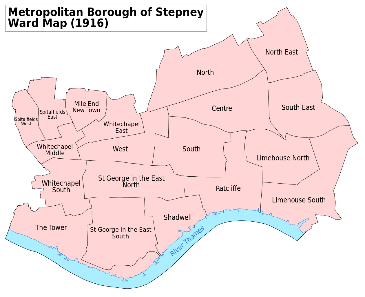
English: A map showing the wards of Stepney Metropolitan Borough as they appeared in 1916. Based on the Ordnance Survey 'County Series 3rd Edition' Map of London (1912-14) Sheets V7, V8, V11, V12, V15 & V16 at 1:2500 scale. Accessed at http://maps.nls.uk/index.html Reproduced with the permission of the National Library of Scotland.
Key: District Boundaries River bank River |
| Date | |
| Source | Own work |
| Author | Doc77can |
Licensing
I, the copyright holder of this work, hereby publish it under the following license:
This file is licensed under the Creative Commons Attribution-Share Alike 4.0 International license.
- You are free:
- to share – to copy, distribute and transmit the work
- to remix – to adapt the work
- Under the following conditions:
- attribution – You must give appropriate credit, provide a link to the license, and indicate if changes were made. You may do so in any reasonable manner, but not in any way that suggests the licensor endorses you or your use.
- share alike – If you remix, transform, or build upon the material, you must distribute your contributions under the same or compatible license as the original.
File history
Click on a date/time to view the file as it appeared at that time.
| Date/Time | Dimensions | User | Comment | |
|---|---|---|---|---|
| current | 09:37, 8 April 2016 | 1,265 × 1,028 (87 KB) | Doc77can | Converted the labels from paths to text and changed the font. |
File usage
The following 4 pages use this file: