File:Survey monument RH00-062 from SW 3.jpg
Size of this preview: 459 × 599 pixels. Other resolutions: 184 × 240 pixels | 368 × 480 pixels | 460 × 600 pixels | 588 × 768 pixels | 785 × 1,024 pixels | 1,650 × 2,153 pixels.
Original file (1,650 × 2,153 pixels, file size: 1.45 MB, MIME type: image/jpeg)
| This is a file from the Wikimedia Commons. The description on its description page there is shown below.
|
|
This is an image of a place or building that is listed on the National Register of Historic Places in the United States of America. Its reference number is 87001001. |
Summary
| Description |
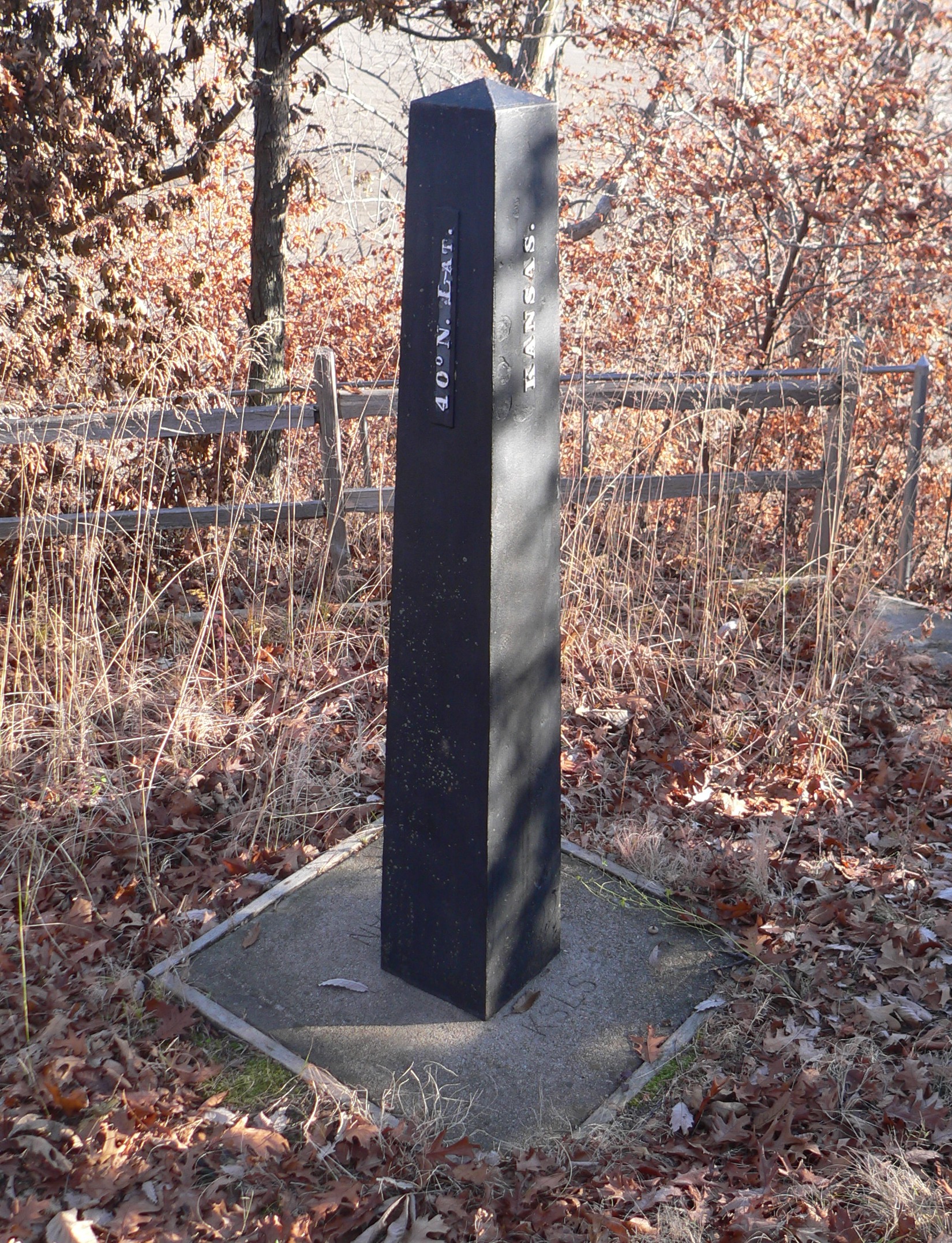
English: Survey monument RH00:062, located on 40th parallel (Kansas-Nebraska border), atop bluff near Missouri River and Kansas Highway 7; seen from the southwest. "Kansas" is inscribed on the south face; "40° N. LAT." on the west. |
| Date | |
| Source | Own work |
| Author | Ammodramus |
| Object location | | View this and other nearby images on: OpenStreetMap |
|---|
Licensing
I, the copyright holder of this work, hereby publish it under the following license:
| This file is made available under the Creative Commons CC0 1.0 Universal Public Domain Dedication. | |
| The person who associated a work with this deed has dedicated the work to the public domain by waiving all of their rights to the work worldwide under copyright law, including all related and neighboring rights, to the extent allowed by law. You can copy, modify, distribute and perform the work, even for commercial purposes, all without asking permission.
|
File history
Click on a date/time to view the file as it appeared at that time.
| Date/Time | Dimensions | User | Comment | |
|---|---|---|---|---|
| current | 07:44, 18 November 2011 | 1,650 × 2,153 (1.45 MB) | Ammodramus |
File usage
The following page uses this file: