File:Taagepera mõisa peahoone2.jpg

Size of this preview: 785 × 599 pixels. Other resolutions: 314 × 240 pixels | 629 × 480 pixels | 786 × 600 pixels | 1,006 × 768 pixels | 1,280 × 978 pixels | 4,164 × 3,180 pixels.
Original file (4,164 × 3,180 pixels, file size: 8.53 MB, MIME type: image/jpeg)
| This is a file from the Wikimedia Commons. The description on its description page there is shown below.
|
Summary
| Description |
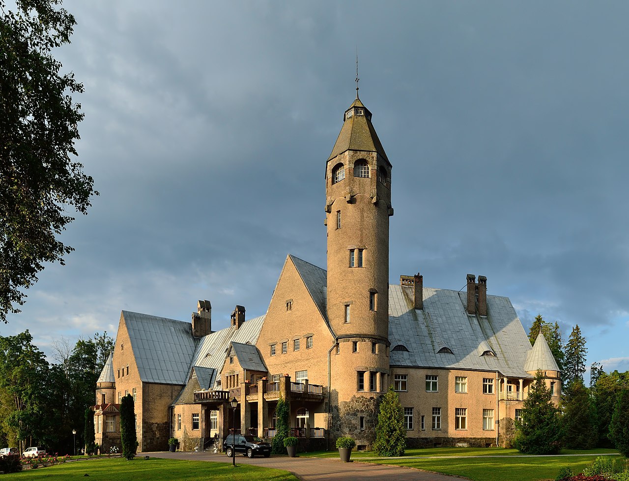
Eesti: Taagepera mõisa peahoone, ehitatud 1907-1912. English: Taagepera manor main building, built in 1907-1912.
|
||
| Date | |||
| Source | Own work | ||
| Author | Ivar Leidus | ||
| Other versions |
|

| Camera location | | View this and other nearby images on: OpenStreetMap |
|---|
|
This image was selected as picture of the day on Wikimedia Commons for 5 February 2013. It was captioned as follows: English: Taagepera manor main building in Estonia. Other languages:
Deutsch: Schloss Taagepera im gleichnamigen Ort im estnischen Kreis Valga Eesti: Taagepera mõisa peahoone. English: Taagepera manor main building in Estonia. Esperanto: Taagepera mõis ĉefakonstruaĵo en Estonio. Italiano: Edificio principale del castello Taagepera in Estonia. Magyar: Az észtországi Taagepera kastély fő épülete Nederlands: Het hoofdgebouw van kasteel Taagepera in Estland. Slovenščina: Glavna stavba dvorca Taagepera v Estoniji 中文: 爱沙尼亚塔格佩拉城堡。。 |
This image was created with Hugin.
Licensing
I, the copyright holder of this work, hereby publish it under the following license:
This file is licensed under the Creative Commons Attribution-ShareAlike 3.0 Estonia license.
- You are free:
- to share – to copy, distribute and transmit the work
- to remix – to adapt the work
- Under the following conditions:
- attribution – You must give appropriate credit, provide a link to the license, and indicate if changes were made. You may do so in any reasonable manner, but not in any way that suggests the licensor endorses you or your use.
- share alike – If you remix, transform, or build upon the material, you must distribute your contributions under the same or compatible license as the original.


|
This image was uploaded as part of Wiki Loves Monuments 2012.
|
File history
Click on a date/time to view the file as it appeared at that time.
| Date/Time | Dimensions | User | Comment | |
|---|---|---|---|---|
| current | 05:42, 27 April 2013 | 4,164 × 3,180 (8.53 MB) | Iifar | Minor increase of sharpness and crop |
File usage
The following page uses this file: