File:Tectonic setting western Mexico.png

Size of this preview: 737 × 600 pixels. Other resolutions: 295 × 240 pixels | 590 × 480 pixels | 944 × 768 pixels | 1,258 × 1,024 pixels | 1,929 × 1,570 pixels.
Original file (1,929 × 1,570 pixels, file size: 1.8 MB, MIME type: image/png)
| This is a file from the Wikimedia Commons. The description on its description page there is shown below.
|
Summary
| Description |
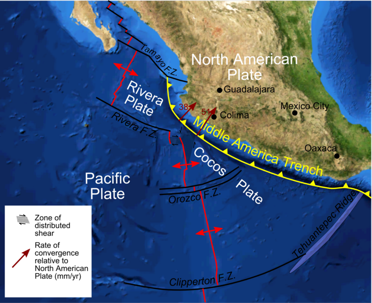
English: Map of plate boundaries on the Pacific coast of western Mexico on a a base of a screenshot from Nasa World Wind software - boundaries taken from a variety of sources including Pardo & Suarez 1995, de Mets & Wilson 1997 |
| Date | |
| Source | Own work |
| Author | Mikenorton |
Licensing
I, the copyright holder of this work, hereby publish it under the following license:
This file is licensed under the Creative Commons Attribution-Share Alike 3.0 Unported license.
- You are free:
- to share – to copy, distribute and transmit the work
- to remix – to adapt the work
- Under the following conditions:
- attribution – You must give appropriate credit, provide a link to the license, and indicate if changes were made. You may do so in any reasonable manner, but not in any way that suggests the licensor endorses you or your use.
- share alike – If you remix, transform, or build upon the material, you must distribute your contributions under the same or compatible license as the original.
File history
Click on a date/time to view the file as it appeared at that time.
| Date/Time | Dimensions | User | Comment | |
|---|---|---|---|---|
| current | 04:04, 31 December 2011 | 1,929 × 1,570 (1.8 MB) | Mikenorton | Change 'Middle American' to 'Middle America' and add location of Guadalajara |
File usage
The following page uses this file: