File:Territory of the Republic of Ragusa early 18th century.png
Size of this preview: 769 × 600 pixels. Other resolutions: 308 × 240 pixels | 616 × 480 pixels | 985 × 768 pixels | 1,241 × 968 pixels.
Original file (1,241 × 968 pixels, file size: 2.56 MB, MIME type: image/png)
| This is a file from the Wikimedia Commons. The description on its description page there is shown below.
|
Summary
| Description |
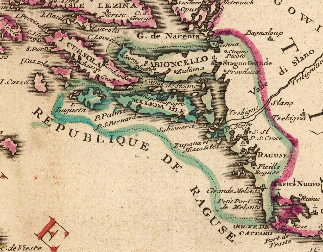
English: Territory of the Republic of Ragusa in the early 18th century. Cropped from a map by French cartographer Nicolas de Fer titled Le Golfe de Venise (etc.). Circa 1716. |
| Date | early 18th century |
| Source | David Rumsey Historical Maps for sale |
| Author | Nicolas de Fer, c. 1716 |
Licensing
|
This work is in the public domain in its country of origin and other countries and areas where the copyright term is the author's life plus 100 years or fewer. | |
| This file has been identified as being free of known restrictions under copyright law, including all related and neighboring rights. | |
File history
Click on a date/time to view the file as it appeared at that time.
| Date/Time | Dimensions | User | Comment | |
|---|---|---|---|---|
| current | 07:02, 16 August 2015 | 1,241 × 968 (2.56 MB) | Lubiesque | User created page with UploadWizard |
File usage
The following page uses this file: