File:The Florida straits, the L-shaped channel between southeastern Florida and the Bahamas, and the Florida Keys and Cuba.gif

Size of this preview: 650 × 600 pixels. Other resolutions: 260 × 240 pixels | 520 × 480 pixels | 832 × 768 pixels | 1,109 × 1,024 pixels | 1,300 × 1,200 pixels.
Original file (1,300 × 1,200 pixels, file size: 618 KB, MIME type: image/gif)
| This is a file from the Wikimedia Commons. The description on its description page there is shown below.
|
Summary
| Description |
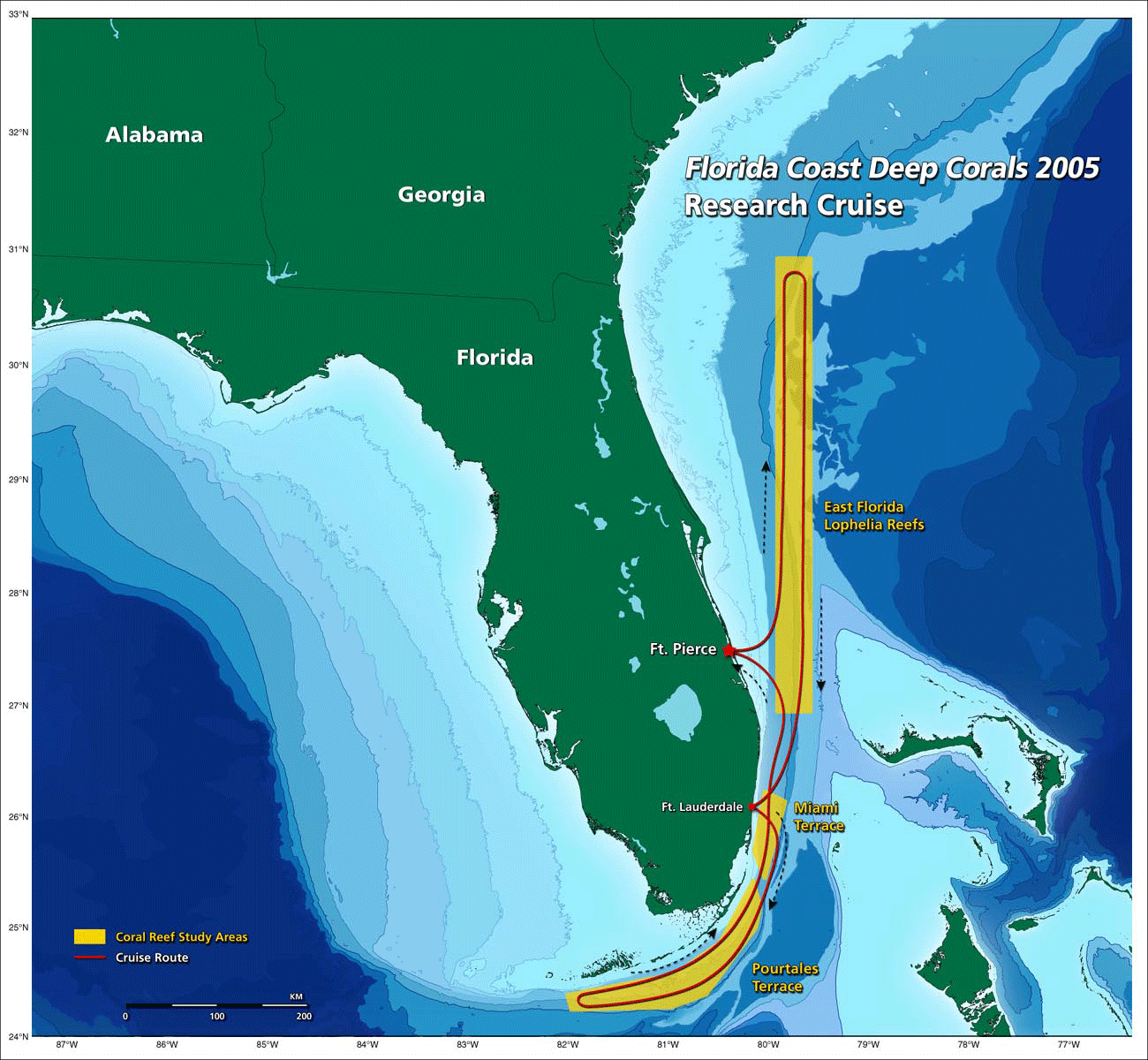
English: the Florida straits, the L-shaped channel between southeastern Florida and the Bahamas, and the Florida Keys and Cuba.[1] |
| Date | 20:22, 30 October 2009 (UTC) |
| Source | http://oceanexplorer.noaa.gov/explorations/05deepcorals/background/mission_plan/media/map_600.gif |
| Author | Image courtesy of NOAA OE. |
| Permission (Reusing this file) |
U.S. Government work |
Licensing
This image is in the public domain because it contains materials that originally came from the U.S. National Oceanic and Atmospheric Administration, taken or made as part of an employee's official duties.
|
File history
Click on a date/time to view the file as it appeared at that time.
| Date/Time | Dimensions | User | Comment | |
|---|---|---|---|---|
| current | 13:22, 30 October 2009 | 1,300 × 1,200 (618 KB) | Mattisse | {{Information |Description = the Florida straits, the L-shaped channel between southeastern Florida and the Bahamas, and the Florida Keys and Cuba.[http://oceanexplorer.noaa.gov/explorations/05deepcorals/background/mission_plan/media/map_600.html] |S |
File usage
The following page uses this file: