File:Thuringia Tambach-Dietharz asv2020-07 img29 Falkenstein.jpg

Size of this preview: 480 × 600 pixels. Other resolutions: 192 × 240 pixels | 384 × 480 pixels | 614 × 768 pixels | 819 × 1,024 pixels | 5,304 × 6,630 pixels.
Original file (5,304 × 6,630 pixels, file size: 16.25 MB, MIME type: image/jpeg)
| This is a file from the Wikimedia Commons. The description on its description page there is shown below.
|
Summary
| Description |
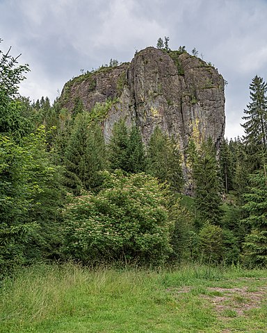
Deutsch: Felsformation Falkenstein bei Tambach-Dietharz, Thüringen, Deutschland
English: Falkenstein rock near Tambach-Dietharz, Thuringia, Germany
Русский: Утёс Фалькенштайн около города Тамбах-Дитарц, Тюрингия, Германия |
| Date | |
| Source | Own work |
| Author | A.Savin |
| Permission (Reusing this file) |
.svg) Just attribute the author: «A.Savin, Wikipedia»; if you have questions — Telegram, or e-mail to wikiphotospace@gmail.com..svg) Просто укажите в качестве автора: «А.Савин, Википедия»; если есть вопрос — телеграм, или эл.почта на wikiphotospace@gmail.com. Kennzeichnen Sie einfach als Autor: «A.Savin, Wikipedia»; falls Sie Fragen haben — Telegram, oder E-Mail an wikiphotospace@gmail.com.
Thank you. |
| Camera location | | View this and other nearby images on: OpenStreetMap |
|---|
Licensing
| Copyleft: This work of art is free; you can redistribute it and/or modify it according to terms of the Free Art License. You will find a specimen of this license on the Copyleft Attitude site as well as on other sites. |
File history
Click on a date/time to view the file as it appeared at that time.
| Date/Time | Dimensions | User | Comment | |
|---|---|---|---|---|
| current | 07:17, 13 February 2021 | 5,304 × 6,630 (16.25 MB) | A.Savin | {{User:A.Savin/F|L=0 |Description= {{de|Felsformation Falkenstein bei Tambach-Dietharz, Thüringen, Deutschland}} {{en|Falkenstein rock near Tambach-Dietharz, Thuringia, Germany}} {{ru|Утёс Фалькенштайн около города Тамбах-Дитарц, Тюрингия, Германия}} |Year=2020 |Country=Germany |Month=07 |Day=18}} {{Location|50|44|48.4|N|10|38|32|E|region:DE-TH}} Category:Taken with Sony ILCE-7RM3 Category:Taken with Sony FE 24-105mm F4 G OSS Category:July 2020 in Thuringia [[Category:Falkenstein... |
File usage
The following page uses this file: