File:Tintigny Luxembourg Belgium Map.png
No higher resolution available.
Tintigny_Luxembourg_Belgium_Map.png (220 × 290 pixels, file size: 5 KB, MIME type: image/png)
| This is a file from the Wikimedia Commons. The description on its description page there is shown below.
|

|
This locator map image could be re-created using vector graphics as an SVG file. This has several advantages; see Commons:Media for cleanup for more information. If an SVG form of this image is available, please upload it and afterwards replace this template with
{{vector version available|new image name}}.
It is recommended to name the SVG file “Tintigny Luxembourg Belgium Map.svg”—then the template Vector version available (or Vva) does not need the new image name parameter. |
Brezhoneg: Lec'hiañ Tintigny, Belgia.
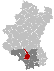
English: Map, municipality belgium Tintigny. Map from w:nl:Gebruiker:LennartBolks/kaartenhoekje in Public Domain by the Author choice.
Français : Carte indiquant la localisation de la commune de Tintigny dans la Province de Luxembourg.
| This work has been released into the public domain by its author, LennartBolks. This applies worldwide. In some countries this may not be legally possible; if so: |
File history
Click on a date/time to view the file as it appeared at that time.
| Date/Time | Dimensions | User | Comment | |
|---|---|---|---|---|
| current | 13:24, 20 November 2005 | 220 × 290 (5 KB) | Srtxg | arr. in dark |
File usage
There are no pages that use this file.