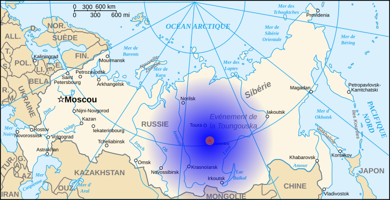
File:Tunguska-Map-fr.svg

Size of this PNG preview of this SVG file: 800 × 409 pixels. Other resolutions: 320 × 164 pixels | 640 × 328 pixels | 1,024 × 524 pixels | 1,280 × 655 pixels | 977 × 500 pixels.
Original file (SVG file, nominally 977 × 500 pixels, file size: 235 KB)
File history
Click on a date/time to view the file as it appeared at that time.
| Date/Time | Dimensions | User | Comment | |
|---|---|---|---|---|
| current | 00:31, 1 July 2008 | 977 × 500 (235 KB) | Denys | {{Information |Description={{fr|1=Situation et zones d'impact de la météorite de la Toungaska. Zone 1 (R=20 km) : forêt détruite (rouge) Zone 2 (R=100 km) : dégâts, brûlures, morts d'animaux (orange) Zone 3 (R=1500 km) : bruit de l'explosion (dégr |
File usage
The following page uses this file:
