File:US SlaveFree1789.gif
No higher resolution available.
US_SlaveFree1789.gif (774 × 468 pixels, file size: 20 KB, MIME type: image/gif)
| This is a file from the Wikimedia Commons. The description on its description page there is shown below.
|
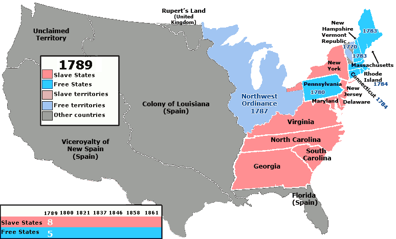
| Description | Map of the states and territories of the United States as it was from March 1789 to August 1789 showing which areas of the United States did and did not allow slavery. Territories and states which had not specifically banned slavery are colored red/pink. |
| Date | (UTC) |
| Source | |
| Author |
|
I, the copyright holder of this work, hereby publish it under the following licenses:
This file is licensed under the Creative Commons Attribution 2.5 Generic license.
- You are free:
- to share – to copy, distribute and transmit the work
- to remix – to adapt the work
- Under the following conditions:
- attribution – You must give appropriate credit, provide a link to the license, and indicate if changes were made. You may do so in any reasonable manner, but not in any way that suggests the licensor endorses you or your use.
| This file is licensed under the Creative Commons Attribution-Share Alike 3.0 Unported license. | ||
| ||
| This licensing tag was added to this file as part of the GFDL licensing update. |

|
Permission is granted to copy, distribute and/or modify this document under the terms of the GNU Free Documentation License, Version 1.2 or any later version published by the Free Software Foundation; with no Invariant Sections, no Front-Cover Texts, and no Back-Cover Texts. A copy of the license is included in the section entitled GNU Free Documentation License. |
You may select the license of your choice.
Original upload log
This image is a derivative work of the following images:
- File:United_States_1789-03-1789-08.png licensed with Cc-by-2.5, Cc-by-sa-3.0-migrated, GFDL
- 2007-08-14T10:58:05Z Golbez 1000x677 (99534 Bytes)
Uploaded with derivativeFX
File history
Click on a date/time to view the file as it appeared at that time.
| Date/Time | Dimensions | User | Comment | |
|---|---|---|---|---|
| current | 13:59, 14 October 2010 | 774 × 468 (20 KB) | Kenmayer | {{Information |Description=Map of the states and territories of the United States as it was from March 1789 to August 1789 showing which areas of the United States did and did not allow slavery. Territories and states which had not specifically banned sla |
File usage
The following page uses this file: