File:US federal land.agencies.svg

Size of this PNG preview of this SVG file: 776 × 600 pixels. Other resolutions: 311 × 240 pixels | 621 × 480 pixels | 994 × 768 pixels | 1,280 × 989 pixels | 990 × 765 pixels.
Original file (SVG file, nominally 990 × 765 pixels, file size: 3.65 MB)
| This is a file from the Wikimedia Commons. The description on its description page there is shown below.
|

|
This file requires updating because: Add American territories In doing so, you could add a timestamp to the file.
|
Department of Defense (includes Army Corps of Engineers projects)
Other agencies
Summary
| Description |
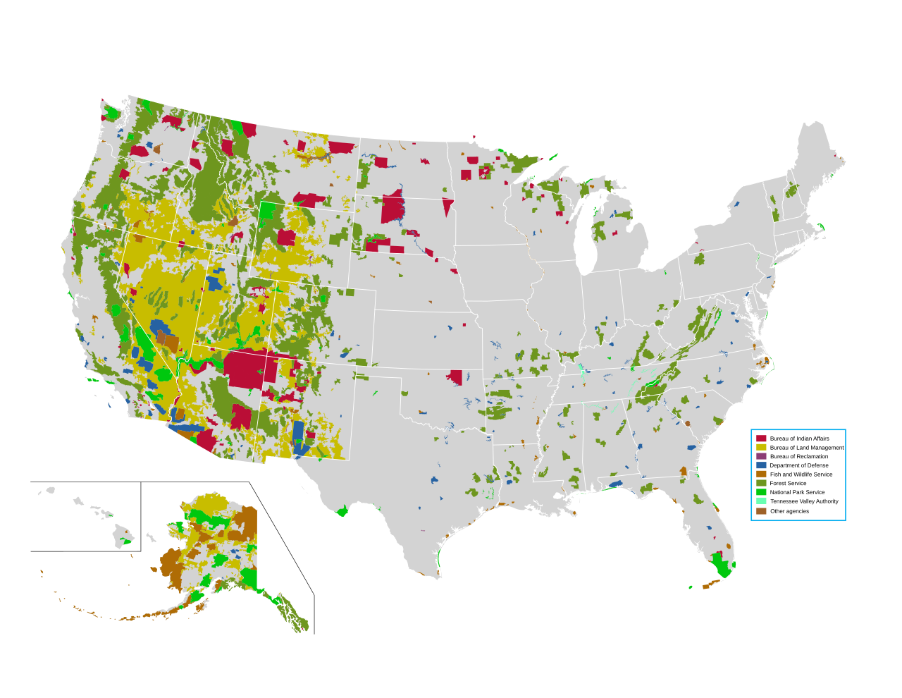
English: Map of all federally owned land in the United States. |
| Source | http://nationalatlas.gov/printable/fedlands.html, "All Federal and Indian Lands" |
| Author | National Atlas of the United States |
Licensing
This map was obtained from an edition of the National Atlas of the United States. Like almost all works of the U.S. federal government, works from the National Atlas are in the public domain in the United States.
Online access: NationalAtlas.gov | 1970 print edition: Library of Congress, Perry-Castañeda Library
|
File history
Click on a date/time to view the file as it appeared at that time.
| Date/Time | Dimensions | User | Comment | |
|---|---|---|---|---|
| current | 15:42, 14 April 2014 | 990 × 765 (3.65 MB) | Interiot~commonswiki | fix text alignment |
File usage
The following page uses this file: