File:Wabash Avenue Bridge Undated NPS.jpg
Size of this preview: 800 × 561 pixels. Other resolutions: 320 × 224 pixels | 640 × 449 pixels | 1,024 × 718 pixels | 1,280 × 897 pixels | 4,650 × 3,260 pixels.
Original file (4,650 × 3,260 pixels, file size: 4.19 MB, MIME type: image/jpeg)
| This is a file from the Wikimedia Commons. The description on its description page there is shown below.
|
Summary
| Description |
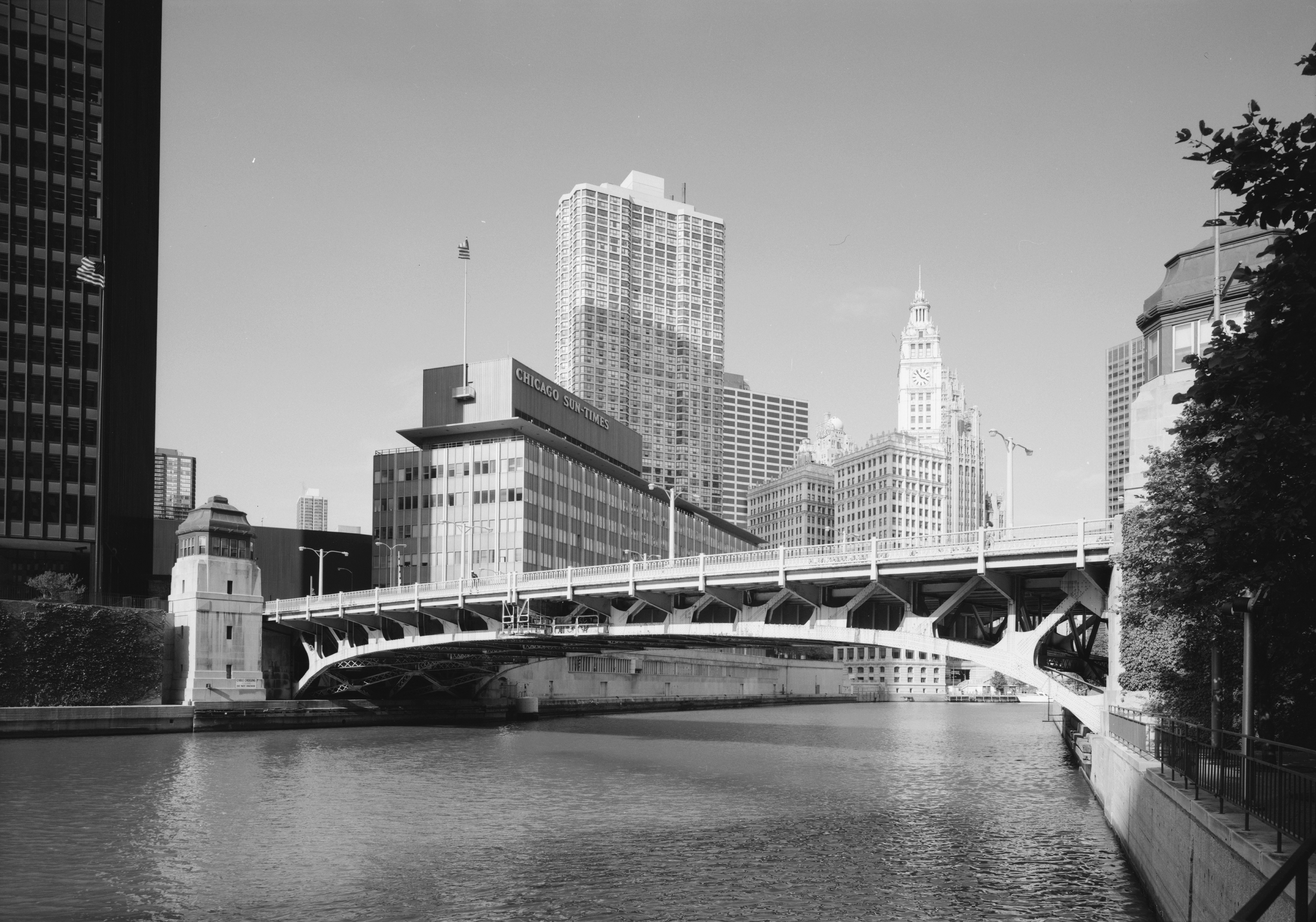
English: Wabash Avenue Bridge looking North East from the South West Chicago, IL The Chicago Sun-Times building was demolished in 2005 to make way for the Trump International Hotel and Tower. |
||
| Date | Summer 1999 | ||
| Source |
Transferred from en.wikipedia to Commons by User:Jay8g using CommonsHelper. |
||
| Author | Jet Lowe (photographer) |

![[1]](http://memory.loc.gov/cgi-bin/displayPhoto.pl?path=/pnp/habshaer/il/il0600/il0613/photos&topImages=037035pr.jpg&topLinks=037035pv.jpg,037035pu.tif&title=3.%20%20VIEW%20OF%20BRIDGE%20FROM%20SOUTHWEST,%20LOOKING%20NORTHEAST.%3cbr%3eHAER%20ILL,%2016-CHIG,%20133-3&displayProfile=0)
| Camera location | | View this and other nearby images on: OpenStreetMap |
|---|
Licensing

|
This file comes from the Historic American Buildings Survey (HABS), Historic American Engineering Record (HAER) or Historic American Landscapes Survey (HALS). These are programs of the National Park Service established for the purpose of documenting historic places. Records consist of measured drawings, archival photographs, and written reports.
|
| This image or media file contains material based on a work of a National Park Service employee, created as part of that person's official duties. As a work of the U.S. federal government, such work is in the public domain in the United States. See the NPS website and NPS copyright policy for more information. |
Original upload log
The original description page was here. All following user names refer to en.wikipedia.
- 2009-05-18 02:47 Naipicnirp 638×456× (81623 bytes) {{Information |Description=Wabash Avenue Bridge looking North East from the South West Chicago, IL |Source=National Park Service http://memory.loc.gov/cgi-bin/displayPhoto.pl?path=/pnp/habshaer/il/il0600/il0613/photos&topImages=037035pr.jpg&
File history
Click on a date/time to view the file as it appeared at that time.
| Date/Time | Dimensions | User | Comment | |
|---|---|---|---|---|
| current | 18:18, 16 August 2011 | 4,650 × 3,260 (4.19 MB) | Ras67 | high resolution |
File usage
The following page uses this file: