File:Wilparting Church 01.jpg

Size of this preview: 800 × 506 pixels. Other resolutions: 320 × 202 pixels | 640 × 405 pixels | 1,024 × 648 pixels | 1,280 × 809 pixels | 4,031 × 2,549 pixels.
Original file (4,031 × 2,549 pixels, file size: 8.2 MB, MIME type: image/jpeg)
| This is a file from the Wikimedia Commons. The description on its description page there is shown below.
|
Summary
| Description |
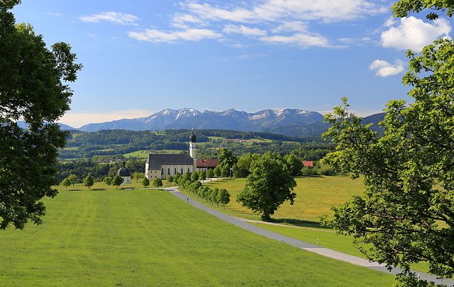
English: St. Marinus and Anian, Wilparting (Irschenberg), Bavaria, as seen from the north.
Español: Vista norte de la iglesia de St. Marinus und Anian en Wilparting (municipio de Irschenberg), Alta Baviera, Alemania.
Français : L'église Saints Marinus et Anianus à Wilparting (Irschenberg), en Bavière, Allemagne, vue du nord.
Polski: Widok od strony północnej na sanktuarium śś. Maryna i Aniana w Wilparting, części Irschenberg w Bawarii.
Português: Vista norte da igreja católica de St. Marinus und Anian em Wilparting, município de Irschenberg, Alta Baviera, Alemanha.
Български: Църквата „Св. Мариний и Аниан“ във Вилпартинг (Иршенберг), Бавария, както се вижда от север.
Deutsch: Die Wallfahrtskirche St. Marinus und Anian in Wilparting, einem Ortsteil von Irschenberg im Landkreis Miesbach, Oberbayern
Magyar: A Szent Marinus és Anian katolikus templom északi oldala (Wilparting, Irschenberg, Bajorország)
Македонски: Црквата „Св. Марин и Анијан“ во Иршенберг, Баварија, Германија.
|
|||||||||||||||||
| Date | ||||||||||||||||||
| Source | Own work | |||||||||||||||||
| Author |
|
|||||||||||||||||

| Camera location | | View this and other nearby images on: OpenStreetMap |
|---|
Assessment
|
This image was selected as picture of the day on Wikimedia Commons for 26 May 2017. It was captioned as follows: English: The church St. Marinus und Anian, Wilparting (Irschenberg), Bavaria, as seen from the north. Other languages:
Deutsch: Die Wallfahrtskirche St. Marinus und Anian in Wilparting, einem Ortsteil von Irschenberg im Landkreis Miesbach, Oberbayern English: The church St. Marinus und Anian, Wilparting (Irschenberg), Bavaria, as seen from the north. Español: Vista norte de la iglesia de St. Marinus und Anian en Wilparting (municipio de Irschenberg), Alta Baviera, Alemania. Français : L'église Saints Marinus et Anianus à Wilparting (Irschenberg), en Bavière, Allemagne, vue du nord. Magyar: A Szent Marinus és Anian katolikus templom északi oldala (Wilparting, Irschenberg, Bajorország) Polski: Widok od strony północnej na sanktuarium śś. Maryna i Aniana w Wilparting, części Irschenberg w Bawarii. Português: Vista norte da igreja católica de St. Marinus und Anian em Wilparting, município de Irschenberg, Alta Baviera, Alemanha. Български: Църквата „Св. Мариний и Аниан“ във Вилпартинг (Иршенберг), Бавария, както се вижда от север. Македонски: Црквата „Св. Марин и Анијан“ во Иршенберг, Баварија, Германија. |
Licensing
I, the copyright holder of this work, hereby publish it under the following license:
This file is licensed under the Creative Commons Attribution-Share Alike 4.0 International license.
- You are free:
- to share – to copy, distribute and transmit the work
- to remix – to adapt the work
- Under the following conditions:
- attribution – You must give appropriate credit, provide a link to the license, and indicate if changes were made. You may do so in any reasonable manner, but not in any way that suggests the licensor endorses you or your use.
- share alike – If you remix, transform, or build upon the material, you must distribute your contributions under the same or compatible license as the original.
File history
Click on a date/time to view the file as it appeared at that time.
| Date/Time | Dimensions | User | Comment | |
|---|---|---|---|---|
| current | 08:13, 22 September 2016 | 4,031 × 2,549 (8.2 MB) | Martin Falbisoner | repaired color profile |
File usage
The following page uses this file: